You are here: Home > Network List > TA - USArray Transportable Network (new EarthScope stations) Stations List
> Station M31M Drury Creek, Yukon, CA > Earthquake Result Viewer
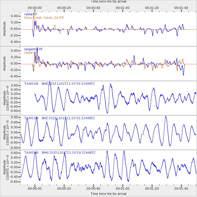
M31M Drury Creek, Yukon, CA - Earthquake Result Viewer
*The percent match for this event was below the threshold and hence no stack was calculated.
| Earthquake location: |
Taiwan Region |
| Earthquake latitude/longitude: |
22.8/121.6 |
| Earthquake time(UTC): |
2015/11/01 (305) 21:09:42 GMT |
| Earthquake Depth: |
14 km |
| Earthquake Magnitude: |
5.5 MB |
| Earthquake Catalog/Contributor: |
NEIC PDE/NEIC COMCAT |
|
| Network: |
TA USArray Transportable Network (new EarthScope stations) |
| Station: |
M31M Drury Creek, Yukon, CA |
| Lat/Lon: |
62.20 N/134.39 W |
| Elevation: |
639 m |
|
| Distance: |
76.4 deg |
| Az: |
27.906 deg |
| Baz: |
292.894 deg |
| Ray Param: |
$rayparam |
*The percent match for this event was below the threshold and hence was not used in the summary stack. |
|
| Radial Match: |
68.293236 % |
| Radial Bump: |
400 |
| Transverse Match: |
70.22091 % |
| Transverse Bump: |
400 |
| SOD ConfigId: |
7422571 |
| Insert Time: |
2019-04-21 05:41:02.700 +0000 |
| GWidth: |
2.5 |
| Max Bumps: |
400 |
| Tol: |
0.001 |
|
Signal To Noise
| Channel | StoN | STA | LTA |
| TA:M31M: :BHZ:20151101T21:20:59.324985Z | 2.0828278 | 5.020723E-7 | 2.410532E-7 |
| TA:M31M: :BHN:20151101T21:20:59.324985Z | 1.4096934 | 4.0238635E-7 | 2.8544247E-7 |
| TA:M31M: :BHE:20151101T21:20:59.324985Z | 0.29101324 | 9.828526E-8 | 3.377347E-7 |
| Arrivals |
| Ps | |
| PpPs | |
| PsPs/PpSs | |


