You are here: Home > Network List > US - United States National Seismic Network Stations List
> Station DGMT Dagmar, Montana, USA > Earthquake Result Viewer
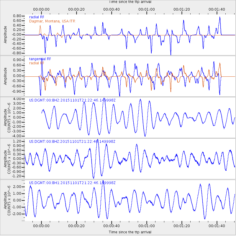
DGMT Dagmar, Montana, USA - Earthquake Result Viewer
*The percent match for this event was below the threshold and hence no stack was calculated.
| Earthquake location: |
Taiwan Region |
| Earthquake latitude/longitude: |
22.8/121.6 |
| Earthquake time(UTC): |
2015/11/01 (305) 21:09:42 GMT |
| Earthquake Depth: |
14 km |
| Earthquake Magnitude: |
5.5 MB |
| Earthquake Catalog/Contributor: |
NEIC PDE/NEIC COMCAT |
|
| Network: |
US United States National Seismic Network |
| Station: |
DGMT Dagmar, Montana, USA |
| Lat/Lon: |
48.47 N/104.20 W |
| Elevation: |
0.0 m |
|
| Distance: |
98.1 deg |
| Az: |
28.802 deg |
| Baz: |
318.084 deg |
| Ray Param: |
$rayparam |
*The percent match for this event was below the threshold and hence was not used in the summary stack. |
|
| Radial Match: |
50.05142 % |
| Radial Bump: |
270 |
| Transverse Match: |
52.818123 % |
| Transverse Bump: |
313 |
| SOD ConfigId: |
7422571 |
| Insert Time: |
2019-04-21 05:41:15.468 +0000 |
| GWidth: |
2.5 |
| Max Bumps: |
400 |
| Tol: |
0.001 |
|
Signal To Noise
| Channel | StoN | STA | LTA |
| US:DGMT:00:BHZ:20151101T21:22:46.149998Z | 0.9868634 | 4.9379435E-7 | 5.003675E-7 |
| US:DGMT:00:BH1:20151101T21:22:46.149998Z | 0.72824246 | 7.747773E-7 | 1.0639002E-6 |
| US:DGMT:00:BH2:20151101T21:22:46.149998Z | 1.6835998 | 2.5960862E-6 | 1.5419853E-6 |
| Arrivals |
| Ps | |
| PpPs | |
| PsPs/PpSs | |


