
BJT Baijiatuan, Beijing, China - Earthquake Result Viewer
| ||||||||||||||||||
| ||||||||||||||||||
| ||||||||||||||||||
|
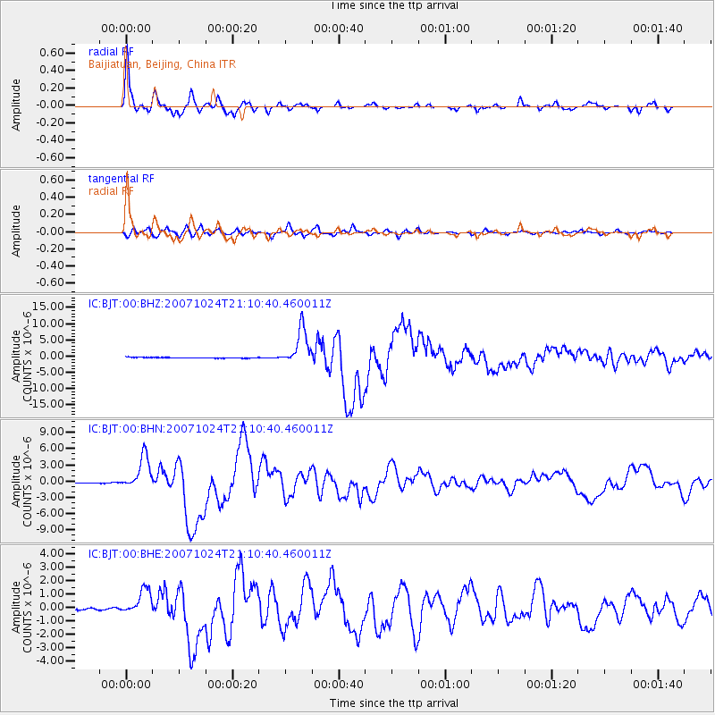
Signal To Noise
| Channel | StoN | STA | LTA |
| IC:BJT:00:BHN:20071024T21:10:40.460011Z | 43.944168 | 3.095011E-6 | 7.043053E-8 |
| IC:BJT:00:BHE:20071024T21:10:40.460011Z | 15.273667 | 9.584523E-7 | 6.2751944E-8 |
| IC:BJT:00:BHZ:20071024T21:10:40.460011Z | 48.135944 | 5.584884E-6 | 1.1602315E-7 |
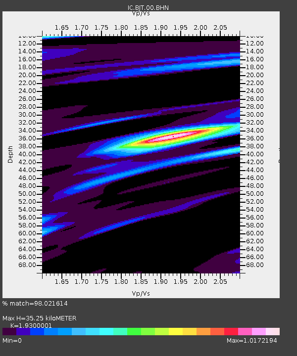
| Arrivals | |
| Ps | 5.4 SECOND |
| PpPs | 15 SECOND |
| PsPs/PpSs | 20 SECOND |

