You are here: Home > Network List > US - United States National Seismic Network Stations List
> Station DGMT Dagmar, Montana, USA > Earthquake Result Viewer
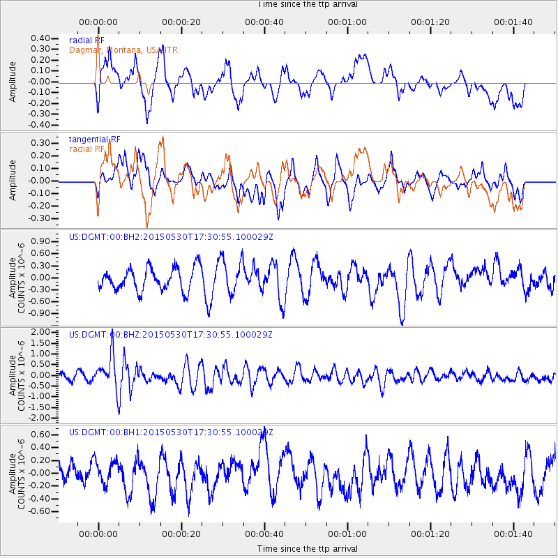
DGMT Dagmar, Montana, USA - Earthquake Result Viewer
*The percent match for this event was below the threshold and hence no stack was calculated.
| Earthquake location: |
Tonga Islands |
| Earthquake latitude/longitude: |
-15.7/-173.3 |
| Earthquake time(UTC): |
2015/05/30 (150) 17:18:39 GMT |
| Earthquake Depth: |
51 km |
| Earthquake Magnitude: |
5.8 MB |
| Earthquake Catalog/Contributor: |
NEIC PDE/NEIC COMCAT |
|
| Network: |
US United States National Seismic Network |
| Station: |
DGMT Dagmar, Montana, USA |
| Lat/Lon: |
48.47 N/104.20 W |
| Elevation: |
0.0 m |
|
| Distance: |
88.4 deg |
| Az: |
38.466 deg |
| Baz: |
244.174 deg |
| Ray Param: |
$rayparam |
*The percent match for this event was below the threshold and hence was not used in the summary stack. |
|
| Radial Match: |
56.416405 % |
| Radial Bump: |
400 |
| Transverse Match: |
63.075718 % |
| Transverse Bump: |
400 |
| SOD ConfigId: |
976571 |
| Insert Time: |
2015-06-13 17:58:15.929 +0000 |
| GWidth: |
2.5 |
| Max Bumps: |
400 |
| Tol: |
0.001 |
|
Signal To Noise
| Channel | StoN | STA | LTA |
| US:DGMT:00:BHZ:20150530T17:30:55.100029Z | 5.4840703 | 8.119762E-7 | 1.4806086E-7 |
| US:DGMT:00:BH1:20150530T17:30:55.100029Z | 0.9514537 | 1.7190294E-7 | 1.80674E-7 |
| US:DGMT:00:BH2:20150530T17:30:55.100029Z | 1.5928683 | 4.4297715E-7 | 2.781003E-7 |
| Arrivals |
| Ps | |
| PpPs | |
| PsPs/PpSs | |


