You are here: Home > Network List > TA - USArray Transportable Network (new EarthScope stations) Stations List
> Station MSTX Muleshoe, TX, USA > Earthquake Result Viewer
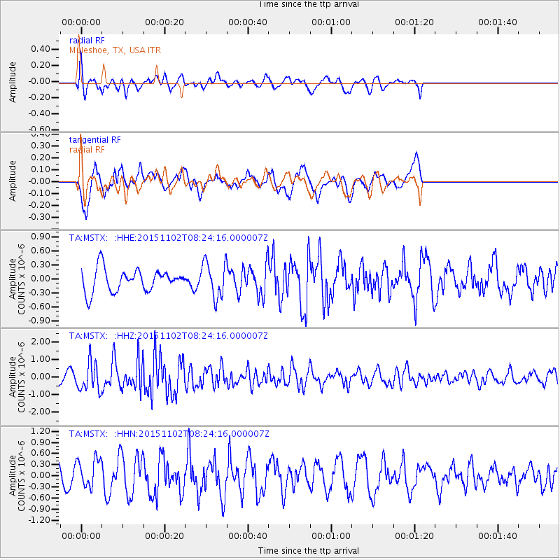
MSTX Muleshoe, TX, USA - Earthquake Result Viewer
*The percent match for this event was below the threshold and hence no stack was calculated.
| Earthquake location: |
Andreanof Islands, Aleutian Is. |
| Earthquake latitude/longitude: |
51.7/-173.4 |
| Earthquake time(UTC): |
2015/11/02 (306) 08:15:34 GMT |
| Earthquake Depth: |
21 km |
| Earthquake Magnitude: |
5.9 MWP, 5.2 MI |
| Earthquake Catalog/Contributor: |
NEIC PDE/NEIC COMCAT |
|
| Network: |
TA USArray Transportable Network (new EarthScope stations) |
| Station: |
MSTX Muleshoe, TX, USA |
| Lat/Lon: |
33.97 N/102.77 W |
| Elevation: |
1167 m |
|
| Distance: |
52.7 deg |
| Az: |
80.512 deg |
| Baz: |
312.323 deg |
| Ray Param: |
$rayparam |
*The percent match for this event was below the threshold and hence was not used in the summary stack. |
|
| Radial Match: |
58.375004 % |
| Radial Bump: |
400 |
| Transverse Match: |
81.62437 % |
| Transverse Bump: |
400 |
| SOD ConfigId: |
7422571 |
| Insert Time: |
2019-04-21 05:51:46.056 +0000 |
| GWidth: |
2.5 |
| Max Bumps: |
400 |
| Tol: |
0.001 |
|
Signal To Noise
| Channel | StoN | STA | LTA |
| TA:MSTX: :HHZ:20151102T08:24:16.000007Z | 4.269712 | 8.3333265E-7 | 1.9517304E-7 |
| TA:MSTX: :HHN:20151102T08:24:16.000007Z | 1.5124588 | 3.841662E-7 | 2.540011E-7 |
| TA:MSTX: :HHE:20151102T08:24:16.000007Z | 1.5914614 | 3.8393094E-7 | 2.4124427E-7 |
| Arrivals |
| Ps | |
| PpPs | |
| PsPs/PpSs | |


