You are here: Home > Network List > TA - USArray Transportable Network (new EarthScope stations) Stations List
> Station O48A Farmland, IN, USA > Earthquake Result Viewer
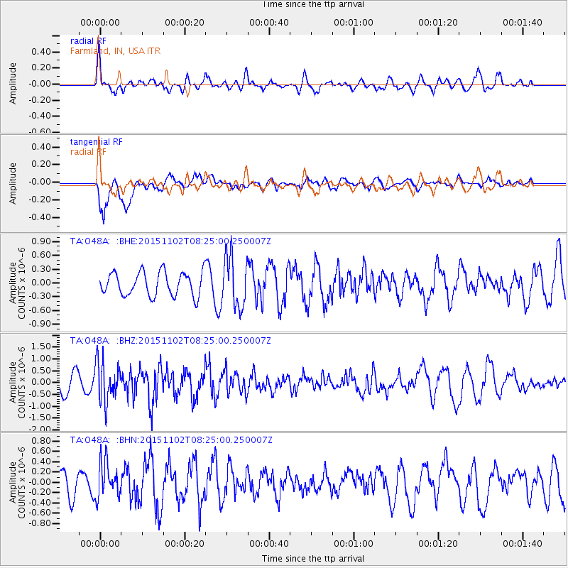
O48A Farmland, IN, USA - Earthquake Result Viewer
*The percent match for this event was below the threshold and hence no stack was calculated.
| Earthquake location: |
Andreanof Islands, Aleutian Is. |
| Earthquake latitude/longitude: |
51.7/-173.4 |
| Earthquake time(UTC): |
2015/11/02 (306) 08:15:34 GMT |
| Earthquake Depth: |
21 km |
| Earthquake Magnitude: |
5.9 MWP, 5.2 MI |
| Earthquake Catalog/Contributor: |
NEIC PDE/NEIC COMCAT |
|
| Network: |
TA USArray Transportable Network (new EarthScope stations) |
| Station: |
O48A Farmland, IN, USA |
| Lat/Lon: |
40.26 N/85.16 W |
| Elevation: |
300 m |
|
| Distance: |
58.8 deg |
| Az: |
63.411 deg |
| Baz: |
313.285 deg |
| Ray Param: |
$rayparam |
*The percent match for this event was below the threshold and hence was not used in the summary stack. |
|
| Radial Match: |
64.2848 % |
| Radial Bump: |
400 |
| Transverse Match: |
91.01876 % |
| Transverse Bump: |
379 |
| SOD ConfigId: |
7422571 |
| Insert Time: |
2019-04-21 05:51:50.261 +0000 |
| GWidth: |
2.5 |
| Max Bumps: |
400 |
| Tol: |
0.001 |
|
Signal To Noise
| Channel | StoN | STA | LTA |
| TA:O48A: :BHZ:20151102T08:25:00.250007Z | 1.6609869 | 8.407963E-7 | 5.0620287E-7 |
| TA:O48A: :BHN:20151102T08:25:00.250007Z | 1.0848219 | 3.4634564E-7 | 3.1926496E-7 |
| TA:O48A: :BHE:20151102T08:25:00.250007Z | 2.1334481 | 5.6791004E-7 | 2.661935E-7 |
| Arrivals |
| Ps | |
| PpPs | |
| PsPs/PpSs | |


