You are here: Home > Network List > TA - USArray Transportable Network (new EarthScope stations) Stations List
> Station W41B Gary Mavity, Velonia, AR, USA > Earthquake Result Viewer
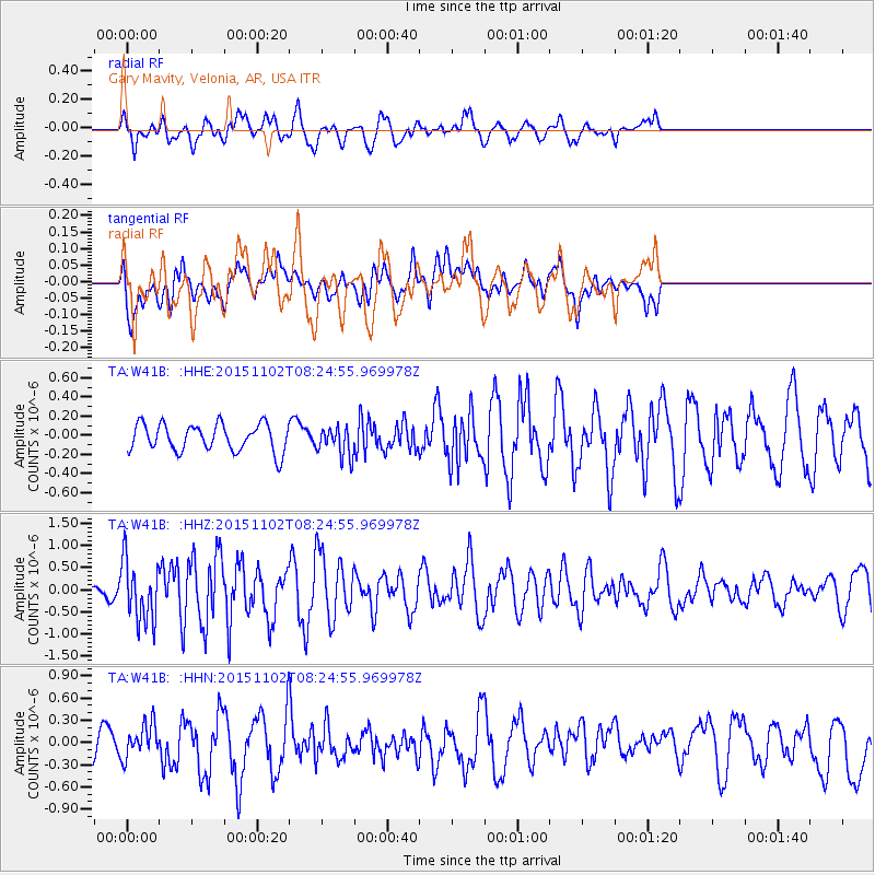
W41B Gary Mavity, Velonia, AR, USA - Earthquake Result Viewer
*The percent match for this event was below the threshold and hence no stack was calculated.
| Earthquake location: |
Andreanof Islands, Aleutian Is. |
| Earthquake latitude/longitude: |
51.7/-173.4 |
| Earthquake time(UTC): |
2015/11/02 (306) 08:15:34 GMT |
| Earthquake Depth: |
21 km |
| Earthquake Magnitude: |
5.9 MWP, 5.2 MI |
| Earthquake Catalog/Contributor: |
NEIC PDE/NEIC COMCAT |
|
| Network: |
TA USArray Transportable Network (new EarthScope stations) |
| Station: |
W41B Gary Mavity, Velonia, AR, USA |
| Lat/Lon: |
35.17 N/92.25 W |
| Elevation: |
95 m |
|
| Distance: |
58.2 deg |
| Az: |
72.265 deg |
| Baz: |
313.589 deg |
| Ray Param: |
$rayparam |
*The percent match for this event was below the threshold and hence was not used in the summary stack. |
|
| Radial Match: |
54.28489 % |
| Radial Bump: |
400 |
| Transverse Match: |
40.638447 % |
| Transverse Bump: |
400 |
| SOD ConfigId: |
7422571 |
| Insert Time: |
2019-04-21 05:52:02.147 +0000 |
| GWidth: |
2.5 |
| Max Bumps: |
400 |
| Tol: |
0.001 |
|
Signal To Noise
| Channel | StoN | STA | LTA |
| TA:W41B: :HHZ:20151102T08:24:55.969978Z | 3.5853937 | 6.8341706E-7 | 1.9061144E-7 |
| TA:W41B: :HHN:20151102T08:24:55.969978Z | 1.3358905 | 2.3066897E-7 | 1.7267058E-7 |
| TA:W41B: :HHE:20151102T08:24:55.969978Z | 1.0994982 | 1.5768634E-7 | 1.4341664E-7 |
| Arrivals |
| Ps | |
| PpPs | |
| PsPs/PpSs | |


