You are here: Home > Network List > PF - Volcanologic Network of Piton de Fournaise-OVPF Stations List
> Station HIM cratere Himiltrude > Earthquake Result Viewer
HIM cratere Himiltrude - Earthquake Result Viewer
*The percent match for this event was below the threshold and hence no stack was calculated.
| Earthquake location: |
Timor Region |
| Earthquake latitude/longitude: |
-8.4/124.9 |
| Earthquake time(UTC): |
2015/11/04 (308) 03:44:15 GMT |
| Earthquake Depth: |
14 km |
| Earthquake Magnitude: |
6.3 MWP |
| Earthquake Catalog/Contributor: |
NEIC PDE/NEIC COMCAT |
|
| Network: |
PF Volcanologic Network of Piton de Fournaise-OVPF |
| Station: |
HIM cratere Himiltrude |
| Lat/Lon: |
21.21 S/55.72 E |
| Elevation: |
1958 m |
|
| Distance: |
67.7 deg |
| Az: |
250.545 deg |
| Baz: |
90.505 deg |
| Ray Param: |
$rayparam |
*The percent match for this event was below the threshold and hence was not used in the summary stack. |
|
| Radial Match: |
42.568954 % |
| Radial Bump: |
400 |
| Transverse Match: |
55.180595 % |
| Transverse Bump: |
400 |
| SOD ConfigId: |
7422571 |
| Insert Time: |
2019-04-21 06:01:46.835 +0000 |
| GWidth: |
2.5 |
| Max Bumps: |
400 |
| Tol: |
0.001 |
|
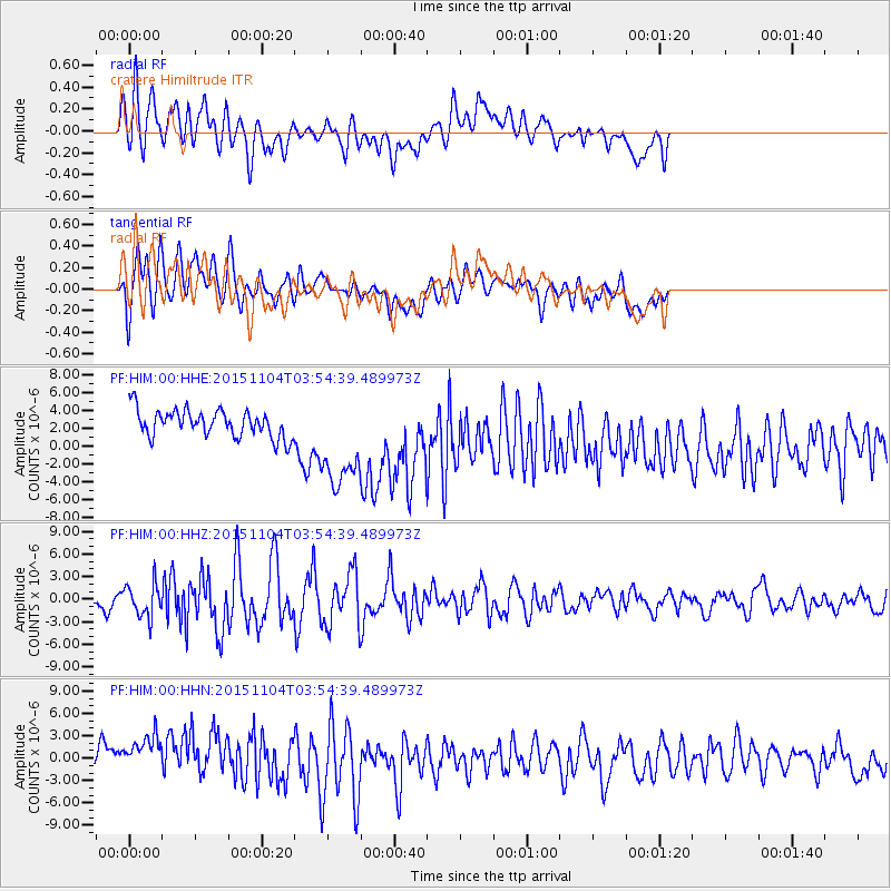
Signal To Noise
| Channel | StoN | STA | LTA |
| PF:HIM:00:HHZ:20151104T03:54:39.489973Z | 2.0255146 | 2.193328E-6 | 1.0828497E-6 |
| PF:HIM:00:HHN:20151104T03:54:39.489973Z | 2.8360054 | 4.1201924E-6 | 1.4528154E-6 |
| PF:HIM:00:HHE:20151104T03:54:39.489973Z | 3.9942195 | 5.9903587E-6 | 1.499757E-6 |
| Arrivals |
| Ps | |
| PpPs | |
| PsPs/PpSs | |


