You are here: Home > Network List > US - United States National Seismic Network Stations List
> Station DGMT Dagmar, Montana, USA > Earthquake Result Viewer
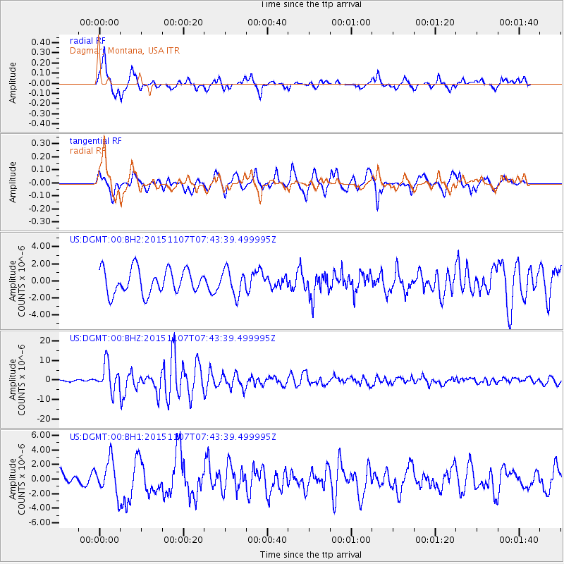
DGMT Dagmar, Montana, USA - Earthquake Result Viewer
*The percent match for this event was below the threshold and hence no stack was calculated.
| Earthquake location: |
Near Coast Of Central Chile |
| Earthquake latitude/longitude: |
-30.9/-71.5 |
| Earthquake time(UTC): |
2015/11/07 (311) 07:31:42 GMT |
| Earthquake Depth: |
36 km |
| Earthquake Magnitude: |
6.8 MWP, 6.8 MI |
| Earthquake Catalog/Contributor: |
NEIC PDE/NEIC COMCAT |
|
| Network: |
US United States National Seismic Network |
| Station: |
DGMT Dagmar, Montana, USA |
| Lat/Lon: |
48.47 N/104.20 W |
| Elevation: |
0.0 m |
|
| Distance: |
84.3 deg |
| Az: |
338.846 deg |
| Baz: |
152.22 deg |
| Ray Param: |
$rayparam |
*The percent match for this event was below the threshold and hence was not used in the summary stack. |
|
| Radial Match: |
81.89205 % |
| Radial Bump: |
400 |
| Transverse Match: |
75.87684 % |
| Transverse Bump: |
390 |
| SOD ConfigId: |
7422571 |
| Insert Time: |
2019-04-21 06:33:33.708 +0000 |
| GWidth: |
2.5 |
| Max Bumps: |
400 |
| Tol: |
0.001 |
|
Signal To Noise
| Channel | StoN | STA | LTA |
| US:DGMT:00:BHZ:20151107T07:43:39.499995Z | 14.674251 | 7.082581E-6 | 4.8265366E-7 |
| US:DGMT:00:BH1:20151107T07:43:39.499995Z | 2.5368955 | 2.3817722E-6 | 9.3885313E-7 |
| US:DGMT:00:BH2:20151107T07:43:39.499995Z | 1.0635438 | 1.5106034E-6 | 1.420349E-6 |
| Arrivals |
| Ps | |
| PpPs | |
| PsPs/PpSs | |


