You are here: Home > Network List > GS - US Geological Survey Networks Stations List
> Station KAN13 Rinehart Farm > Earthquake Result Viewer
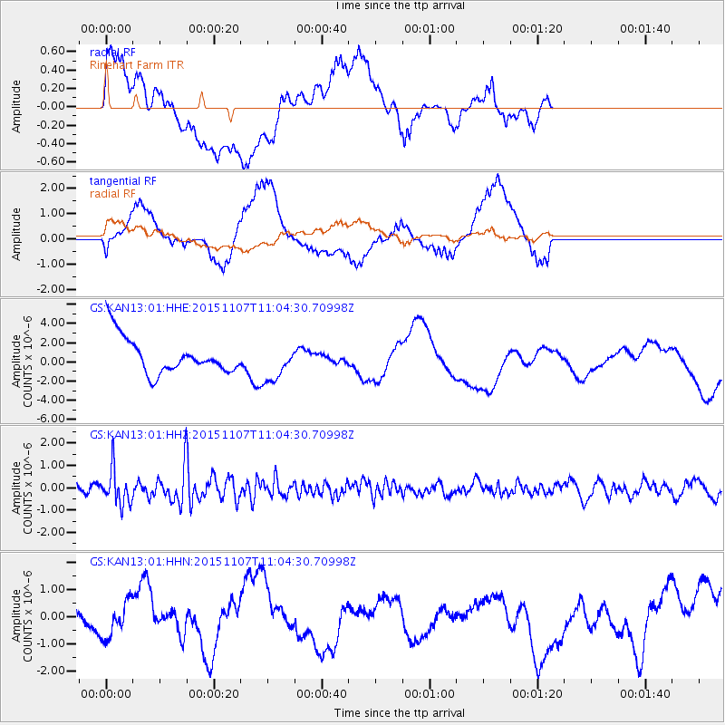
KAN13 Rinehart Farm - Earthquake Result Viewer
*The percent match for this event was below the threshold and hence no stack was calculated.
| Earthquake location: |
Near Coast Of Central Chile |
| Earthquake latitude/longitude: |
-30.7/-71.3 |
| Earthquake time(UTC): |
2015/11/07 (311) 10:53:38 GMT |
| Earthquake Depth: |
3.8 km |
| Earthquake Magnitude: |
5.9 MB |
| Earthquake Catalog/Contributor: |
NEIC PDE/NEIC COMCAT |
|
| Network: |
GS US Geological Survey Networks |
| Station: |
KAN13 Rinehart Farm |
| Lat/Lon: |
37.01 N/97.48 W |
| Elevation: |
340 m |
|
| Distance: |
71.7 deg |
| Az: |
338.196 deg |
| Baz: |
156.45 deg |
| Ray Param: |
$rayparam |
*The percent match for this event was below the threshold and hence was not used in the summary stack. |
|
| Radial Match: |
47.229206 % |
| Radial Bump: |
400 |
| Transverse Match: |
48.97016 % |
| Transverse Bump: |
400 |
| SOD ConfigId: |
7422571 |
| Insert Time: |
2019-04-21 06:39:16.433 +0000 |
| GWidth: |
2.5 |
| Max Bumps: |
400 |
| Tol: |
0.001 |
|
Signal To Noise
| Channel | StoN | STA | LTA |
| GS:KAN13:01:HHZ:20151107T11:04:30.70998Z | 3.9684224 | 7.8634406E-7 | 1.9815029E-7 |
| GS:KAN13:01:HHN:20151107T11:04:30.70998Z | 1.1652997 | 6.359238E-7 | 5.4571694E-7 |
| GS:KAN13:01:HHE:20151107T11:04:30.70998Z | 1.0704964 | 2.0330767E-6 | 1.8991905E-6 |
| Arrivals |
| Ps | |
| PpPs | |
| PsPs/PpSs | |


