You are here: Home > Network List > IW - Intermountain West Stations List
> Station MOOW Moose Ponds, Wyoming, USA > Earthquake Result Viewer
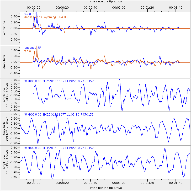
MOOW Moose Ponds, Wyoming, USA - Earthquake Result Viewer
*The percent match for this event was below the threshold and hence no stack was calculated.
| Earthquake location: |
Near Coast Of Central Chile |
| Earthquake latitude/longitude: |
-30.7/-71.3 |
| Earthquake time(UTC): |
2015/11/07 (311) 10:53:38 GMT |
| Earthquake Depth: |
3.8 km |
| Earthquake Magnitude: |
5.9 MB |
| Earthquake Catalog/Contributor: |
NEIC PDE/NEIC COMCAT |
|
| Network: |
IW Intermountain West |
| Station: |
MOOW Moose Ponds, Wyoming, USA |
| Lat/Lon: |
43.75 N/110.74 W |
| Elevation: |
2128 m |
|
| Distance: |
82.4 deg |
| Az: |
332.347 deg |
| Baz: |
146.535 deg |
| Ray Param: |
$rayparam |
*The percent match for this event was below the threshold and hence was not used in the summary stack. |
|
| Radial Match: |
86.413284 % |
| Radial Bump: |
400 |
| Transverse Match: |
61.113102 % |
| Transverse Bump: |
400 |
| SOD ConfigId: |
7422571 |
| Insert Time: |
2019-04-21 06:39:33.903 +0000 |
| GWidth: |
2.5 |
| Max Bumps: |
400 |
| Tol: |
0.001 |
|
Signal To Noise
| Channel | StoN | STA | LTA |
| IW:MOOW:00:BHZ:20151107T11:05:30.745015Z | 2.603735 | 4.2932757E-7 | 1.6488912E-7 |
| IW:MOOW:00:BH1:20151107T11:05:30.745015Z | 2.5810006 | 3.1677948E-7 | 1.2273514E-7 |
| IW:MOOW:00:BH2:20151107T11:05:30.745015Z | 1.1830999 | 1.4280135E-7 | 1.2070102E-7 |
| Arrivals |
| Ps | |
| PpPs | |
| PsPs/PpSs | |


