You are here: Home > Network List > TA - USArray Transportable Network (new EarthScope stations) Stations List
> Station O48A Farmland, IN, USA > Earthquake Result Viewer
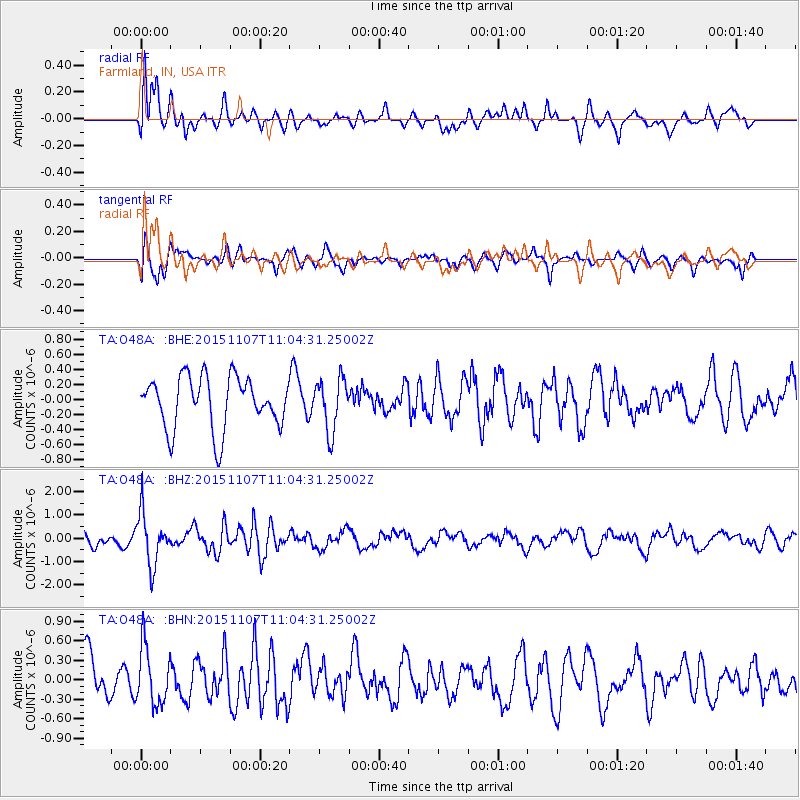
O48A Farmland, IN, USA - Earthquake Result Viewer
*The percent match for this event was below the threshold and hence no stack was calculated.
| Earthquake location: |
Near Coast Of Central Chile |
| Earthquake latitude/longitude: |
-30.7/-71.3 |
| Earthquake time(UTC): |
2015/11/07 (311) 10:53:38 GMT |
| Earthquake Depth: |
3.8 km |
| Earthquake Magnitude: |
5.9 MB |
| Earthquake Catalog/Contributor: |
NEIC PDE/NEIC COMCAT |
|
| Network: |
TA USArray Transportable Network (new EarthScope stations) |
| Station: |
O48A Farmland, IN, USA |
| Lat/Lon: |
40.26 N/85.16 W |
| Elevation: |
300 m |
|
| Distance: |
71.8 deg |
| Az: |
348.905 deg |
| Baz: |
167.496 deg |
| Ray Param: |
$rayparam |
*The percent match for this event was below the threshold and hence was not used in the summary stack. |
|
| Radial Match: |
71.4356 % |
| Radial Bump: |
400 |
| Transverse Match: |
59.885414 % |
| Transverse Bump: |
400 |
| SOD ConfigId: |
7422571 |
| Insert Time: |
2019-04-21 06:43:29.339 +0000 |
| GWidth: |
2.5 |
| Max Bumps: |
400 |
| Tol: |
0.001 |
|
Signal To Noise
| Channel | StoN | STA | LTA |
| TA:O48A: :BHZ:20151107T11:04:31.25002Z | 2.6999383 | 1.1005088E-6 | 4.0760517E-7 |
| TA:O48A: :BHN:20151107T11:04:31.25002Z | 1.1771214 | 4.4518424E-7 | 3.7819737E-7 |
| TA:O48A: :BHE:20151107T11:04:31.25002Z | 1.0064076 | 3.484624E-7 | 3.4624384E-7 |
| Arrivals |
| Ps | |
| PpPs | |
| PsPs/PpSs | |


