You are here: Home > Network List > US - United States National Seismic Network Stations List
> Station DGMT Dagmar, Montana, USA > Earthquake Result Viewer
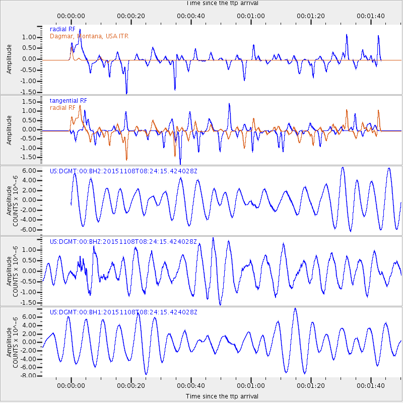
DGMT Dagmar, Montana, USA - Earthquake Result Viewer
*The percent match for this event was below the threshold and hence no stack was calculated.
| Earthquake location: |
Peru-Bolivia Border Region |
| Earthquake latitude/longitude: |
-17.3/-69.5 |
| Earthquake time(UTC): |
2015/11/08 (312) 08:13:36 GMT |
| Earthquake Depth: |
152 km |
| Earthquake Magnitude: |
5.7 MWW, 5.7 MWC, 5.7 MWB |
| Earthquake Catalog/Contributor: |
NEIC PDE/NEIC COMCAT |
|
| Network: |
US United States National Seismic Network |
| Station: |
DGMT Dagmar, Montana, USA |
| Lat/Lon: |
48.47 N/104.20 W |
| Elevation: |
0.0 m |
|
| Distance: |
72.4 deg |
| Az: |
336.577 deg |
| Baz: |
145.2 deg |
| Ray Param: |
$rayparam |
*The percent match for this event was below the threshold and hence was not used in the summary stack. |
|
| Radial Match: |
37.061485 % |
| Radial Bump: |
329 |
| Transverse Match: |
64.33259 % |
| Transverse Bump: |
212 |
| SOD ConfigId: |
7422571 |
| Insert Time: |
2019-04-21 06:57:24.279 +0000 |
| GWidth: |
2.5 |
| Max Bumps: |
400 |
| Tol: |
0.001 |
|
Signal To Noise
| Channel | StoN | STA | LTA |
| US:DGMT:00:BHZ:20151108T08:24:15.424028Z | 0.6540029 | 2.8325883E-7 | 4.3311553E-7 |
| US:DGMT:00:BH1:20151108T08:24:15.424028Z | 3.1470573 | 3.9077986E-6 | 1.2417311E-6 |
| US:DGMT:00:BH2:20151108T08:24:15.424028Z | 0.7711514 | 2.0305545E-6 | 2.6331463E-6 |
| Arrivals |
| Ps | |
| PpPs | |
| PsPs/PpSs | |


