You are here: Home > Network List > GS - US Geological Survey Networks Stations List
> Station DEC05 Decatur Surface Seismic Site, Decatur, IL, USA > Earthquake Result Viewer
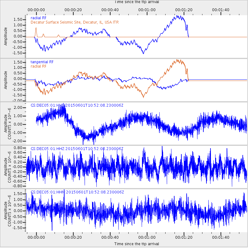
DEC05 Decatur Surface Seismic Site, Decatur, IL, USA - Earthquake Result Viewer
*The percent match for this event was below the threshold and hence no stack was calculated.
| Earthquake location: |
Off Coast Of Oregon |
| Earthquake latitude/longitude: |
44.6/-129.5 |
| Earthquake time(UTC): |
2015/06/01 (152) 10:46:27 GMT |
| Earthquake Depth: |
10 km |
| Earthquake Magnitude: |
5.5 MWP, 5.5 MI |
| Earthquake Catalog/Contributor: |
NEIC PDE/NEIC COMCAT |
|
| Network: |
GS US Geological Survey Networks |
| Station: |
DEC05 Decatur Surface Seismic Site, Decatur, IL, USA |
| Lat/Lon: |
39.87 N/88.87 W |
| Elevation: |
216 m |
|
| Distance: |
30.3 deg |
| Az: |
84.487 deg |
| Baz: |
292.381 deg |
| Ray Param: |
$rayparam |
*The percent match for this event was below the threshold and hence was not used in the summary stack. |
|
| Radial Match: |
25.009935 % |
| Radial Bump: |
400 |
| Transverse Match: |
24.461494 % |
| Transverse Bump: |
400 |
| SOD ConfigId: |
976571 |
| Insert Time: |
2015-06-15 11:04:12.741 +0000 |
| GWidth: |
2.5 |
| Max Bumps: |
400 |
| Tol: |
0.001 |
|
Signal To Noise
| Channel | StoN | STA | LTA |
| GS:DEC05:01:HHZ:20150601T10:52:08.230006Z | 1.2857428 | 2.702557E-7 | 2.1019422E-7 |
| GS:DEC05:01:HHN:20150601T10:52:08.230006Z | 1.0277494 | 6.9786114E-7 | 6.7901874E-7 |
| GS:DEC05:01:HHE:20150601T10:52:08.230006Z | 2.1943097 | 1.9159368E-6 | 8.7313873E-7 |
| Arrivals |
| Ps | |
| PpPs | |
| PsPs/PpSs | |


