You are here: Home > Network List > GS - US Geological Survey Networks Stations List
> Station DEC07 Decatur Surface Seismic Site, Decatur, IL, USA > Earthquake Result Viewer
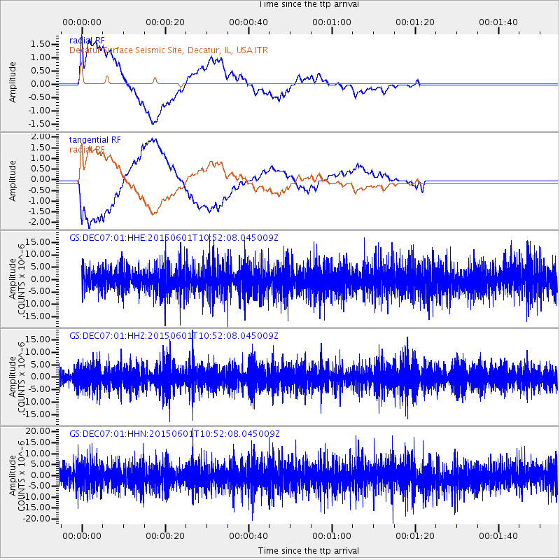
DEC07 Decatur Surface Seismic Site, Decatur, IL, USA - Earthquake Result Viewer
*The percent match for this event was below the threshold and hence no stack was calculated.
| Earthquake location: |
Off Coast Of Oregon |
| Earthquake latitude/longitude: |
44.6/-129.5 |
| Earthquake time(UTC): |
2015/06/01 (152) 10:46:27 GMT |
| Earthquake Depth: |
10 km |
| Earthquake Magnitude: |
5.5 MWP, 5.5 MI |
| Earthquake Catalog/Contributor: |
NEIC PDE/NEIC COMCAT |
|
| Network: |
GS US Geological Survey Networks |
| Station: |
DEC07 Decatur Surface Seismic Site, Decatur, IL, USA |
| Lat/Lon: |
39.86 N/88.90 W |
| Elevation: |
212 m |
|
| Distance: |
30.2 deg |
| Az: |
84.515 deg |
| Baz: |
292.385 deg |
| Ray Param: |
$rayparam |
*The percent match for this event was below the threshold and hence was not used in the summary stack. |
|
| Radial Match: |
39.511223 % |
| Radial Bump: |
400 |
| Transverse Match: |
35.8953 % |
| Transverse Bump: |
400 |
| SOD ConfigId: |
976571 |
| Insert Time: |
2015-06-15 11:04:15.737 +0000 |
| GWidth: |
2.5 |
| Max Bumps: |
400 |
| Tol: |
0.001 |
|
Signal To Noise
| Channel | StoN | STA | LTA |
| GS:DEC07:01:HHZ:20150601T10:52:08.045009Z | 1.6551943 | 4.5728257E-6 | 2.7627125E-6 |
| GS:DEC07:01:HHN:20150601T10:52:08.045009Z | 1.5907662 | 6.2318377E-6 | 3.917507E-6 |
| GS:DEC07:01:HHE:20150601T10:52:08.045009Z | 1.3479415 | 6.300443E-6 | 4.674122E-6 |
| Arrivals |
| Ps | |
| PpPs | |
| PsPs/PpSs | |


