You are here: Home > Network List > TA - USArray Transportable Network (new EarthScope stations) Stations List
> Station Q61A Milford, DE, USA > Earthquake Result Viewer
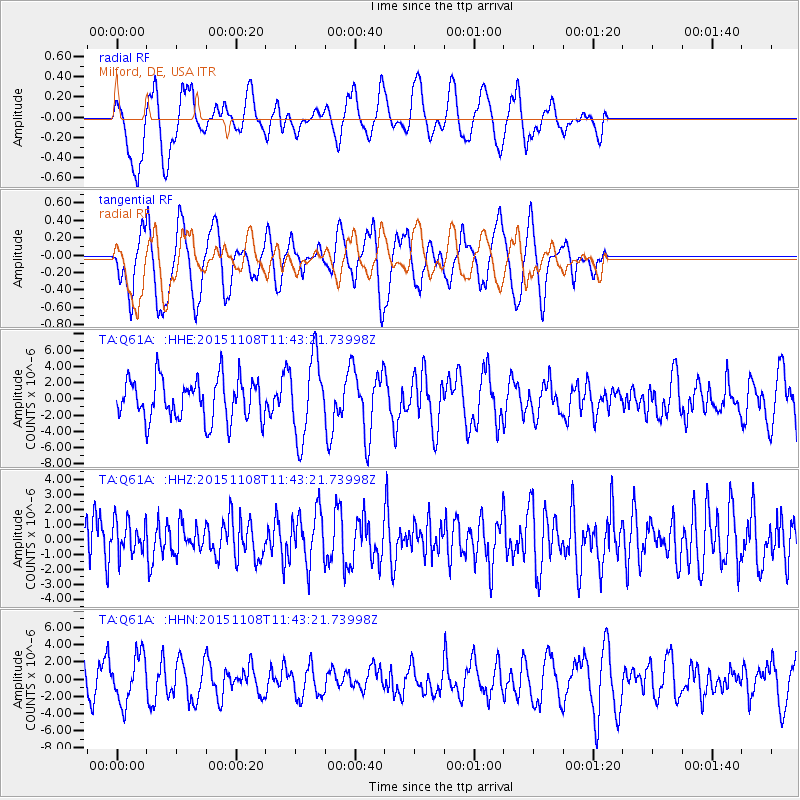
Q61A Milford, DE, USA - Earthquake Result Viewer
*The percent match for this event was below the threshold and hence no stack was calculated.
| Earthquake location: |
Andreanof Islands, Aleutian Is. |
| Earthquake latitude/longitude: |
51.5/-173.0 |
| Earthquake time(UTC): |
2015/11/08 (312) 11:33:16 GMT |
| Earthquake Depth: |
34 km |
| Earthquake Magnitude: |
5.7 MWP, 5.6 MI |
| Earthquake Catalog/Contributor: |
NEIC PDE/NEIC COMCAT |
|
| Network: |
TA USArray Transportable Network (new EarthScope stations) |
| Station: |
Q61A Milford, DE, USA |
| Lat/Lon: |
38.88 N/75.33 W |
| Elevation: |
5.0 m |
|
| Distance: |
65.0 deg |
| Az: |
58.615 deg |
| Baz: |
316.869 deg |
| Ray Param: |
$rayparam |
*The percent match for this event was below the threshold and hence was not used in the summary stack. |
|
| Radial Match: |
60.525963 % |
| Radial Bump: |
400 |
| Transverse Match: |
60.32165 % |
| Transverse Bump: |
369 |
| SOD ConfigId: |
7422571 |
| Insert Time: |
2019-04-21 07:26:48.470 +0000 |
| GWidth: |
2.5 |
| Max Bumps: |
400 |
| Tol: |
0.001 |
|
Signal To Noise
| Channel | StoN | STA | LTA |
| TA:Q61A: :HHZ:20151108T11:43:21.73998Z | 0.92831683 | 1.088656E-6 | 1.1727203E-6 |
| TA:Q61A: :HHN:20151108T11:43:21.73998Z | 1.1286596 | 2.724352E-6 | 2.4137944E-6 |
| TA:Q61A: :HHE:20151108T11:43:21.73998Z | 1.9426758 | 4.9213895E-6 | 2.5333047E-6 |
| Arrivals |
| Ps | |
| PpPs | |
| PsPs/PpSs | |


