
ENH Enshi, Hubei Province, China - Earthquake Result Viewer
| ||||||||||||||||||
| ||||||||||||||||||
| ||||||||||||||||||
|
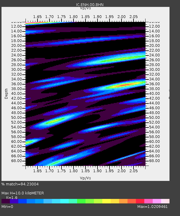
Signal To Noise
| Channel | StoN | STA | LTA |
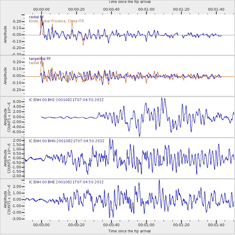
| IC:ENH:00:BHN:20010821T07:04:50.263Z | 1.2172538 | 2.0666835E-7 | 1.6978245E-7 |
| IC:ENH:00:BHE:20010821T07:04:50.263Z | 1.0048239 | 1.9019632E-7 | 1.8928324E-7 |
| IC:ENH:00:BHZ:20010821T07:04:50.263Z | 4.5522943 | 7.7755914E-7 | 1.7080599E-7 |
| Arrivals | |
| Ps | 1.0 SECOND |
| PpPs | 4.2 SECOND |
| PsPs/PpSs | 5.2 SECOND |

