ENH Enshi, Hubei Province, China - Earthquake Result Viewer
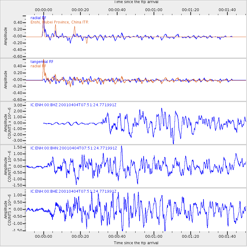
Earthquake location: Aru Islands Region, Indonesia
Earthquake latitude/longitude: -5.2/132.4
Earthquake time(UTC): 2001/04/04 (094) 07:44:11 GMT
Earthquake Depth: 33 km
Earthquake Magnitude: 5.9 MB, 6.0 MS, 6.4 MW, 6.4 MW
Earthquake Catalog/Contributor: WHDF/NEIC
Network: IC New China Digital Seismograph Network
Station: ENH Enshi, Hubei Province, China
Lat/Lon: 30.27 N/109.49 E
Elevation: 487 m
Distance: 41.5 deg
Az: 329.496 deg
Baz: 144.241 deg
Ray Param: 0.07368131
Estimated Moho Depth: 39.25 km
Estimated Crust Vp/Vs: 1.72
Assumed Crust Vp: 6.083 km/s
Estimated Crust Vs: 3.547 km/s
Estimated Crust Poisson's Ratio: 0.24
Radial Match: 92.7849 %
Radial Bump: 400
Transverse Match: 83.79762 %
Transverse Bump: 400
SOD ConfigId: 4714
Insert Time: 2010-03-04 21:45:03.845 +0000
GWidth: 2.5
Max Bumps: 400
Tol: 0.001

Signal To Noise

ChannelStoNSTALTA
IC:ENH:00:BHN:20010404T07:51:24.771991Z2.91975122.1176533E-77.252855E-8
IC:ENH:00:BHE:20010404T07:51:24.771991Z1.96244351.940297E-79.887149E-8
IC:ENH:00:BHZ:20010404T07:51:24.771991Z4.51974445.634662E-71.2466771E-7
Arrivals
Ps4.9 SECOND
PpPs16 SECOND
PsPs/PpSs21 SECOND