You are here: Home > Network List > GS - US Geological Survey Networks Stations List
> Station DEC12 Decatur Surface Seismic Site, Decatur, IL, USA > Earthquake Result Viewer
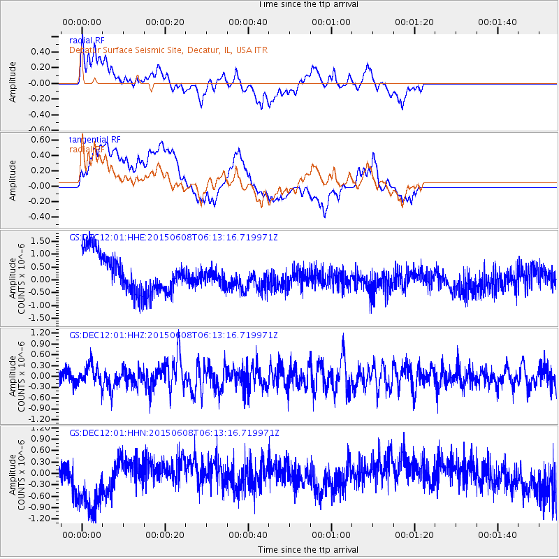
DEC12 Decatur Surface Seismic Site, Decatur, IL, USA - Earthquake Result Viewer
*The percent match for this event was below the threshold and hence no stack was calculated.
| Earthquake location: |
Hokkaido, Japan Region |
| Earthquake latitude/longitude: |
41.5/142.0 |
| Earthquake time(UTC): |
2015/06/08 (159) 06:01:08 GMT |
| Earthquake Depth: |
44 km |
| Earthquake Magnitude: |
6.2 MO |
| Earthquake Catalog/Contributor: |
NEIC PDE/NEIC ALERT |
|
| Network: |
GS US Geological Survey Networks |
| Station: |
DEC12 Decatur Surface Seismic Site, Decatur, IL, USA |
| Lat/Lon: |
39.91 N/88.91 W |
| Elevation: |
208 m |
|
| Distance: |
86.8 deg |
| Az: |
36.695 deg |
| Baz: |
324.274 deg |
| Ray Param: |
$rayparam |
*The percent match for this event was below the threshold and hence was not used in the summary stack. |
|
| Radial Match: |
35.59792 % |
| Radial Bump: |
400 |
| Transverse Match: |
26.082329 % |
| Transverse Bump: |
400 |
| SOD ConfigId: |
976571 |
| Insert Time: |
2015-06-22 06:26:45.866 +0000 |
| GWidth: |
2.5 |
| Max Bumps: |
400 |
| Tol: |
0.001 |
|
Signal To Noise
| Channel | StoN | STA | LTA |
| GS:DEC12:01:HHZ:20150608T06:13:16.719971Z | 1.458583 | 2.8190175E-7 | 1.9327096E-7 |
| GS:DEC12:01:HHN:20150608T06:13:16.719971Z | 1.3754221 | 1.0290512E-6 | 7.4817126E-7 |
| GS:DEC12:01:HHE:20150608T06:13:16.719971Z | 0.37588772 | 2.798854E-7 | 7.445984E-7 |
| Arrivals |
| Ps | |
| PpPs | |
| PsPs/PpSs | |


