You are here: Home > Network List > UW - Pacific Northwest Regional Seismic Network Stations List
> Station UMAT Pilot Rock, OR, USA > Earthquake Result Viewer
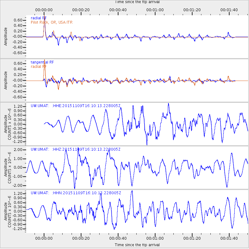
UMAT Pilot Rock, OR, USA - Earthquake Result Viewer
*The percent match for this event was below the threshold and hence no stack was calculated.
| Earthquake location: |
Andreanof Islands, Aleutian Is. |
| Earthquake latitude/longitude: |
51.7/-173.1 |
| Earthquake time(UTC): |
2015/11/09 (313) 16:03:45 GMT |
| Earthquake Depth: |
10 km |
| Earthquake Magnitude: |
6.2 MWB, 6.3 MI |
| Earthquake Catalog/Contributor: |
NEIC PDE/NEIC COMCAT |
|
| Network: |
UW Pacific Northwest Regional Seismic Network |
| Station: |
UMAT Pilot Rock, OR, USA |
| Lat/Lon: |
45.29 N/118.96 W |
| Elevation: |
1318 m |
|
| Distance: |
35.7 deg |
| Az: |
78.497 deg |
| Baz: |
300.316 deg |
| Ray Param: |
$rayparam |
*The percent match for this event was below the threshold and hence was not used in the summary stack. |
|
| Radial Match: |
74.242325 % |
| Radial Bump: |
293 |
| Transverse Match: |
56.772217 % |
| Transverse Bump: |
400 |
| SOD ConfigId: |
7422571 |
| Insert Time: |
2019-04-21 07:54:47.636 +0000 |
| GWidth: |
2.5 |
| Max Bumps: |
400 |
| Tol: |
0.001 |
|
Signal To Noise
| Channel | StoN | STA | LTA |
| UW:UMAT: :HHZ:20151109T16:10:13.228005Z | 1.5239438 | 5.197164E-7 | 3.4103383E-7 |
| UW:UMAT: :HHN:20151109T16:10:13.228005Z | 1.4582298 | 4.0265616E-7 | 2.7612668E-7 |
| UW:UMAT: :HHE:20151109T16:10:13.228005Z | 2.1502247 | 5.941885E-7 | 2.763379E-7 |
| Arrivals |
| Ps | |
| PpPs | |
| PsPs/PpSs | |


