
ENH Enshi, Hubei Province, China - Earthquake Result Viewer
| ||||||||||||||||||
| ||||||||||||||||||
| ||||||||||||||||||
|
Signal To Noise
| Channel | StoN | STA | LTA |
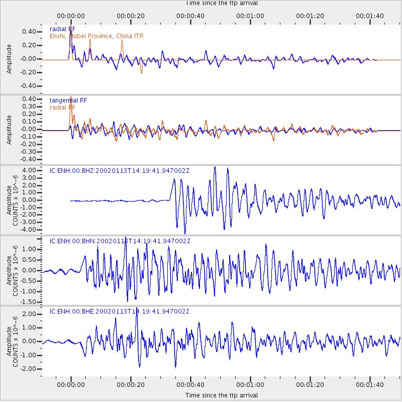
| IC:ENH:00:BHN:20020113T14:19:41.947002Z | 4.8471546 | 2.6340697E-7 | 5.43426E-8 |
| IC:ENH:00:BHE:20020113T14:19:41.947002Z | 6.0320086 | 3.571652E-7 | 5.921165E-8 |
| IC:ENH:00:BHZ:20020113T14:19:41.947002Z | 24.278238 | 1.1172832E-6 | 4.601995E-8 |
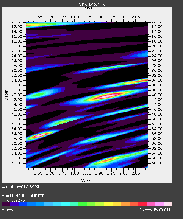
| Arrivals | |
| Ps | 6.5 SECOND |
| PpPs | 19 SECOND |
| PsPs/PpSs | 25 SECOND |

