You are here: Home > Network List > TA - USArray Transportable Network (new EarthScope stations) Stations List
> Station R11A Troy Canyon, Currant, NV, USA > Earthquake Result Viewer
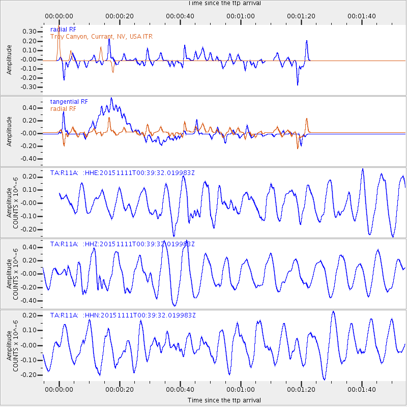
R11A Troy Canyon, Currant, NV, USA - Earthquake Result Viewer
*The percent match for this event was below the threshold and hence no stack was calculated.
| Earthquake location: |
E. Caroline Islands, Micronesia |
| Earthquake latitude/longitude: |
6.2/147.6 |
| Earthquake time(UTC): |
2015/11/11 (315) 00:26:58 GMT |
| Earthquake Depth: |
15 km |
| Earthquake Magnitude: |
5.6 MB |
| Earthquake Catalog/Contributor: |
NEIC PDE/NEIC ALERT |
|
| Network: |
TA USArray Transportable Network (new EarthScope stations) |
| Station: |
R11A Troy Canyon, Currant, NV, USA |
| Lat/Lon: |
38.35 N/115.59 W |
| Elevation: |
1756 m |
|
| Distance: |
91.5 deg |
| Az: |
51.354 deg |
| Baz: |
279.043 deg |
| Ray Param: |
$rayparam |
*The percent match for this event was below the threshold and hence was not used in the summary stack. |
|
| Radial Match: |
61.717953 % |
| Radial Bump: |
400 |
| Transverse Match: |
58.388393 % |
| Transverse Bump: |
400 |
| SOD ConfigId: |
7422571 |
| Insert Time: |
2019-04-21 08:01:37.338 +0000 |
| GWidth: |
2.5 |
| Max Bumps: |
400 |
| Tol: |
0.001 |
|
Signal To Noise
| Channel | StoN | STA | LTA |
| TA:R11A: :HHZ:20151111T00:39:32.019983Z | 0.35115388 | 6.1748395E-8 | 1.7584426E-7 |
| TA:R11A: :HHN:20151111T00:39:32.019983Z | 0.5905046 | 1.1689172E-7 | 1.9795226E-7 |
| TA:R11A: :HHE:20151111T00:39:32.019983Z | 1.2028524 | 7.9396514E-8 | 6.600686E-8 |
| Arrivals |
| Ps | |
| PpPs | |
| PsPs/PpSs | |


