You are here: Home > Network List > UW - Pacific Northwest Regional Seismic Network Stations List
> Station PASS Maple Falls, WA, USA > Earthquake Result Viewer
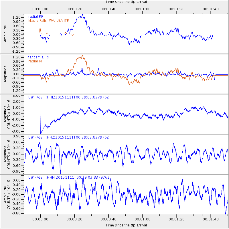
PASS Maple Falls, WA, USA - Earthquake Result Viewer
*The percent match for this event was below the threshold and hence no stack was calculated.
| Earthquake location: |
E. Caroline Islands, Micronesia |
| Earthquake latitude/longitude: |
6.2/147.6 |
| Earthquake time(UTC): |
2015/11/11 (315) 00:26:58 GMT |
| Earthquake Depth: |
15 km |
| Earthquake Magnitude: |
5.6 MB |
| Earthquake Catalog/Contributor: |
NEIC PDE/NEIC ALERT |
|
| Network: |
UW Pacific Northwest Regional Seismic Network |
| Station: |
PASS Maple Falls, WA, USA |
| Lat/Lon: |
49.00 N/122.09 W |
| Elevation: |
174 m |
|
| Distance: |
85.5 deg |
| Az: |
41.344 deg |
| Baz: |
274.288 deg |
| Ray Param: |
$rayparam |
*The percent match for this event was below the threshold and hence was not used in the summary stack. |
|
| Radial Match: |
14.944234 % |
| Radial Bump: |
400 |
| Transverse Match: |
47.86368 % |
| Transverse Bump: |
400 |
| SOD ConfigId: |
7422571 |
| Insert Time: |
2019-04-21 08:02:19.869 +0000 |
| GWidth: |
2.5 |
| Max Bumps: |
400 |
| Tol: |
0.001 |
|
Signal To Noise
| Channel | StoN | STA | LTA |
| UW:PASS: :HHZ:20151111T00:39:03.837976Z | 1.5613488 | 3.3339262E-7 | 2.135286E-7 |
| UW:PASS: :HHN:20151111T00:39:03.837976Z | 0.9314275 | 2.8134963E-7 | 3.0206283E-7 |
| UW:PASS: :HHE:20151111T00:39:03.837976Z | 1.1310899 | 1.2398524E-6 | 1.0961572E-6 |
| Arrivals |
| Ps | |
| PpPs | |
| PsPs/PpSs | |


