ENH Enshi, Hubei Province, China - Earthquake Result Viewer
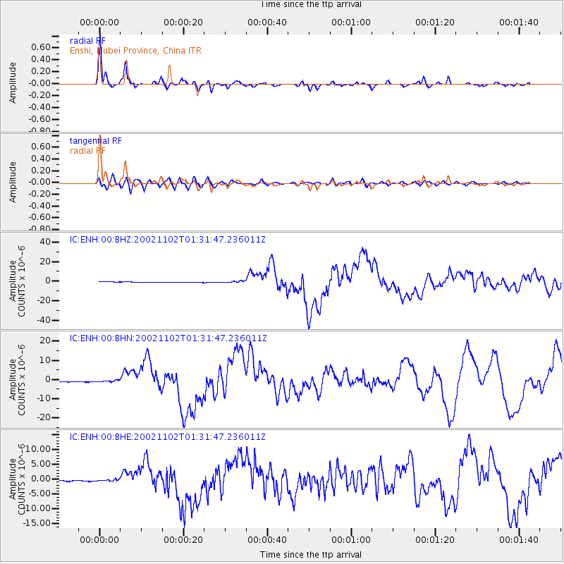
Earthquake location: Northern Sumatra, Indonesia
Earthquake latitude/longitude: 2.8/96.1
Earthquake time(UTC): 2002/11/02 (306) 01:26:10 GMT
Earthquake Depth: 30 km
Earthquake Magnitude: 6.2 MB, 7.6 MS, 7.4 MW, 7.4 MW
Earthquake Catalog/Contributor: WHDF/NEIC
Network: IC New China Digital Seismograph Network
Station: ENH Enshi, Hubei Province, China
Lat/Lon: 30.27 N/109.49 E
Elevation: 487 m
Distance: 30.1 deg
Az: 23.562 deg
Baz: 207.485 deg
Ray Param: 0.079392396
Estimated Moho Depth: 49.5 km
Estimated Crust Vp/Vs: 1.72
Assumed Crust Vp: 6.083 km/s
Estimated Crust Vs: 3.537 km/s
Estimated Crust Poisson's Ratio: 0.24
Radial Match: 92.37477 %
Radial Bump: 347
Transverse Match: 72.27694 %
Transverse Bump: 400
SOD ConfigId: 4714
Insert Time: 2010-03-04 21:47:29.716 +0000
GWidth: 2.5
Max Bumps: 400
Tol: 0.001

Signal To Noise

ChannelStoNSTALTA
IC:ENH:00:BHN:20021102T01:31:47.236011Z1.39523923.737648E-72.6788584E-7
IC:ENH:00:BHE:20021102T01:31:47.236011Z1.54446282.616193E-71.6939178E-7
IC:ENH:00:BHZ:20021102T01:31:47.236011Z3.15487898.9097233E-72.8241095E-7
Arrivals
Ps6.3 SECOND
PpPs21 SECOND
PsPs/PpSs27 SECOND