
ENH Enshi, Hubei Province, China - Earthquake Result Viewer
| ||||||||||||||||||
| ||||||||||||||||||
| ||||||||||||||||||
|
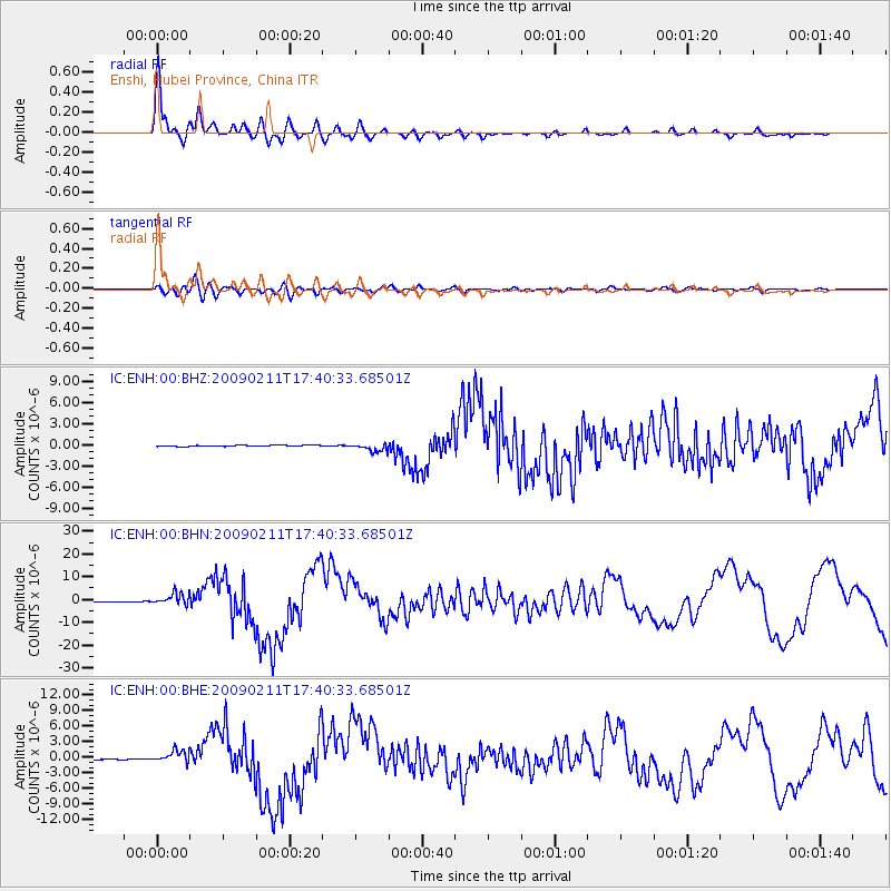
Signal To Noise
| Channel | StoN | STA | LTA |
| IC:ENH:00:BHN:20090211T17:40:33.68501Z | 28.131556 | 2.5754182E-6 | 9.154908E-8 |
| IC:ENH:00:BHE:20090211T17:40:33.68501Z | 12.251888 | 1.1498958E-6 | 9.385457E-8 |
| IC:ENH:00:BHZ:20090211T17:40:33.68501Z | 6.6048403 | 6.108001E-7 | 9.2477656E-8 |
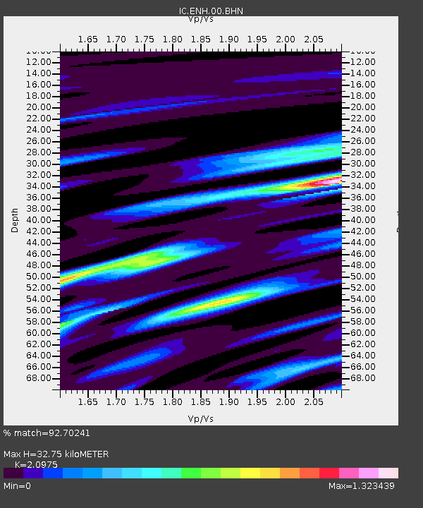
| Arrivals | |
| Ps | 6.3 SECOND |
| PpPs | 16 SECOND |
| PsPs/PpSs | 22 SECOND |

