
ENH Enshi, Hubei Province, China - Earthquake Result Viewer
| ||||||||||||||||||
| ||||||||||||||||||
| ||||||||||||||||||
|
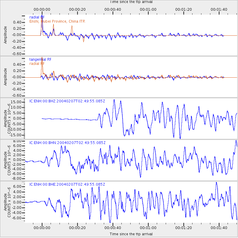
Signal To Noise
| Channel | StoN | STA | LTA |
| IC:ENH:00:BHN:20040207T02:49:55.085Z | 4.68423 | 1.1331963E-6 | 2.4191732E-7 |
| IC:ENH:00:BHE:20040207T02:49:55.085Z | 3.3387196 | 7.880486E-7 | 2.3603319E-7 |
| IC:ENH:00:BHZ:20040207T02:49:55.085Z | 10.724447 | 3.369474E-6 | 3.1418628E-7 |
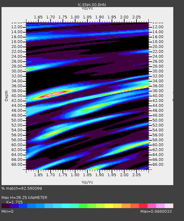
| Arrivals | |
| Ps | 4.8 SECOND |
| PpPs | 16 SECOND |
| PsPs/PpSs | 21 SECOND |

