You are here: Home > Network List > GS - US Geological Survey Networks Stations List
> Station DEC06 Boomer, Decatur, IL, USA > Earthquake Result Viewer
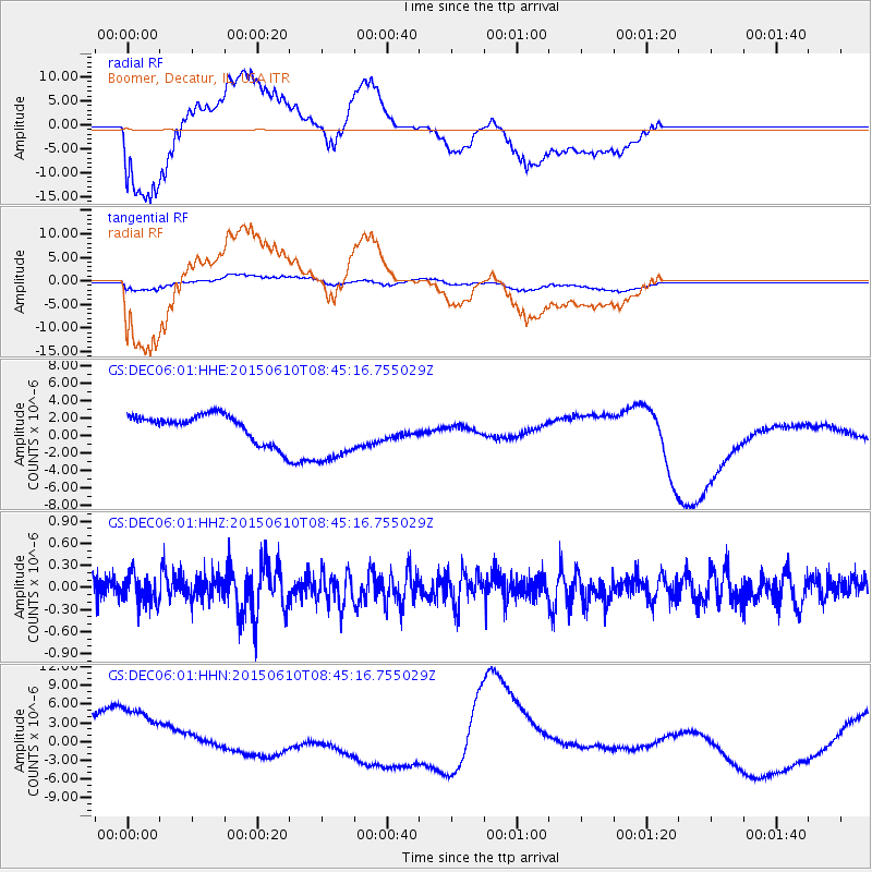
DEC06 Boomer, Decatur, IL, USA - Earthquake Result Viewer
*The percent match for this event was below the threshold and hence no stack was calculated.
| Earthquake location: |
Off East Coast Of Honshu, Japan |
| Earthquake latitude/longitude: |
39.6/143.4 |
| Earthquake time(UTC): |
2015/06/10 (161) 08:33:02 GMT |
| Earthquake Depth: |
26 km |
| Earthquake Magnitude: |
5.5 MB |
| Earthquake Catalog/Contributor: |
NEIC PDE/NEIC ALERT |
|
| Network: |
GS US Geological Survey Networks |
| Station: |
DEC06 Boomer, Decatur, IL, USA |
| Lat/Lon: |
39.90 N/88.95 W |
| Elevation: |
215 m |
|
| Distance: |
87.6 deg |
| Az: |
37.537 deg |
| Baz: |
322.3 deg |
| Ray Param: |
$rayparam |
*The percent match for this event was below the threshold and hence was not used in the summary stack. |
|
| Radial Match: |
80.59376 % |
| Radial Bump: |
400 |
| Transverse Match: |
63.58477 % |
| Transverse Bump: |
400 |
| SOD ConfigId: |
976571 |
| Insert Time: |
2015-06-24 09:05:22.485 +0000 |
| GWidth: |
2.5 |
| Max Bumps: |
400 |
| Tol: |
0.001 |
|
Signal To Noise
| Channel | StoN | STA | LTA |
| GS:DEC06:01:HHZ:20150610T08:45:16.755029Z | 1.5326331 | 1.9409117E-7 | 1.2663902E-7 |
| GS:DEC06:01:HHN:20150610T08:45:16.755029Z | 2.4775848 | 7.2792254E-6 | 2.9380328E-6 |
| GS:DEC06:01:HHE:20150610T08:45:16.755029Z | 2.307196 | 3.5477863E-6 | 1.5377049E-6 |
| Arrivals |
| Ps | |
| PpPs | |
| PsPs/PpSs | |


