You are here: Home > Network List > TA - USArray Transportable Network (new EarthScope stations) Stations List
> Station W41B Gary Mavity, Velonia, AR, USA > Earthquake Result Viewer
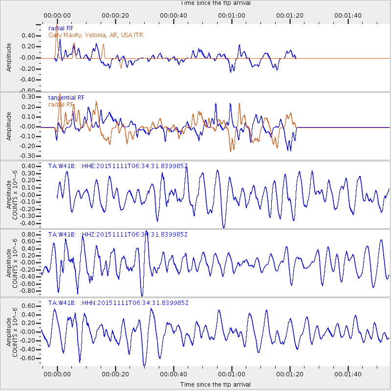
W41B Gary Mavity, Velonia, AR, USA - Earthquake Result Viewer
*The percent match for this event was below the threshold and hence no stack was calculated.
| Earthquake location: |
Central East Pacific Rise |
| Earthquake latitude/longitude: |
-9.1/-108.6 |
| Earthquake time(UTC): |
2015/11/11 (315) 06:26:33 GMT |
| Earthquake Depth: |
10 km |
| Earthquake Magnitude: |
5.6 mwb |
| Earthquake Catalog/Contributor: |
NEIC PDE/us |
|
| Network: |
TA USArray Transportable Network (new EarthScope stations) |
| Station: |
W41B Gary Mavity, Velonia, AR, USA |
| Lat/Lon: |
35.17 N/92.25 W |
| Elevation: |
95 m |
|
| Distance: |
46.7 deg |
| Az: |
18.521 deg |
| Baz: |
202.513 deg |
| Ray Param: |
$rayparam |
*The percent match for this event was below the threshold and hence was not used in the summary stack. |
|
| Radial Match: |
61.436962 % |
| Radial Bump: |
400 |
| Transverse Match: |
55.530167 % |
| Transverse Bump: |
400 |
| SOD ConfigId: |
7422571 |
| Insert Time: |
2019-04-21 08:33:35.416 +0000 |
| GWidth: |
2.5 |
| Max Bumps: |
400 |
| Tol: |
0.001 |
|
Signal To Noise
| Channel | StoN | STA | LTA |
| TA:W41B: :HHZ:20151111T06:34:31.839985Z | 1.6095148 | 4.19891E-7 | 2.6088048E-7 |
| TA:W41B: :HHN:20151111T06:34:31.839985Z | 1.6993049 | 3.4390004E-7 | 2.0237688E-7 |
| TA:W41B: :HHE:20151111T06:34:31.839985Z | 1.12079 | 1.5670238E-7 | 1.3981422E-7 |
| Arrivals |
| Ps | |
| PpPs | |
| PsPs/PpSs | |


