You are here: Home > Network List > WY - Yellowstone Wyoming Seismic Network Stations List
> Station YHH Holmes Hill, YNP, WY, USA > Earthquake Result Viewer
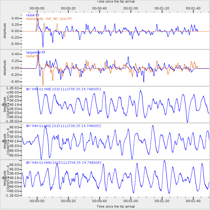
YHH Holmes Hill, YNP, WY, USA - Earthquake Result Viewer
*The percent match for this event was below the threshold and hence no stack was calculated.
| Earthquake location: |
Central East Pacific Rise |
| Earthquake latitude/longitude: |
-9.1/-108.6 |
| Earthquake time(UTC): |
2015/11/11 (315) 06:26:33 GMT |
| Earthquake Depth: |
10 km |
| Earthquake Magnitude: |
5.6 mwb |
| Earthquake Catalog/Contributor: |
NEIC PDE/us |
|
| Network: |
WY Yellowstone Wyoming Seismic Network |
| Station: |
YHH Holmes Hill, YNP, WY, USA |
| Lat/Lon: |
44.79 N/110.85 W |
| Elevation: |
2717 m |
|
| Distance: |
53.7 deg |
| Az: |
358.051 deg |
| Baz: |
177.297 deg |
| Ray Param: |
$rayparam |
*The percent match for this event was below the threshold and hence was not used in the summary stack. |
|
| Radial Match: |
75.439514 % |
| Radial Bump: |
386 |
| Transverse Match: |
50.277153 % |
| Transverse Bump: |
361 |
| SOD ConfigId: |
7422571 |
| Insert Time: |
2019-04-21 08:34:23.550 +0000 |
| GWidth: |
2.5 |
| Max Bumps: |
400 |
| Tol: |
0.001 |
|
Signal To Noise
| Channel | StoN | STA | LTA |
| WY:YHH:01:HHZ:20151111T06:35:24.748005Z | 2.368178 | 5.623586E-9 | 2.3746467E-9 |
| WY:YHH:01:HHN:20151111T06:35:24.748005Z | 1.3352507 | 3.3291359E-9 | 2.4932665E-9 |
| WY:YHH:01:HHE:20151111T06:35:24.748005Z | 1.0232788 | 4.3609907E-9 | 4.2617816E-9 |
| Arrivals |
| Ps | |
| PpPs | |
| PsPs/PpSs | |


