You are here: Home > Network List > IC - New China Digital Seismograph Network Stations List
> Station ENH Enshi, Hubei Province, China > Earthquake Result Viewer
ENH Enshi, Hubei Province, China - Earthquake Result Viewer

| Earthquake location: |
Eastern New Guinea Reg., P.N.G. |
| Earthquake latitude/longitude: |
-5.8/147.1 |
| Earthquake time(UTC): |
2007/11/22 (326) 08:48:27 GMT |
| Earthquake Depth: |
53 km |
| Earthquake Magnitude: |
6.0 MB, 6.7 MW, 6.7 MW |
| Earthquake Catalog/Contributor: |
WHDF/NEIC |
|
| Network: |
IC New China Digital Seismograph Network |
| Station: |
ENH Enshi, Hubei Province, China |
| Lat/Lon: |
30.27 N/109.49 E |
| Elevation: |
487 m |
|
| Distance: |
50.8 deg |
| Az: |
317.06 deg |
| Baz: |
128.415 deg |
| Ray Param: |
0.06767544 |
| Estimated Moho Depth: |
33.75 km |
| Estimated Crust Vp/Vs: |
2.10 |
| Assumed Crust Vp: |
6.083 km/s |
| Estimated Crust Vs: |
2.9 km/s |
| Estimated Crust Poisson's Ratio: |
0.35 |
|
| Radial Match: |
92.47132 % |
| Radial Bump: |
400 |
| Transverse Match: |
84.30425 % |
| Transverse Bump: |
400 |
| SOD ConfigId: |
2564 |
| Insert Time: |
2010-03-04 21:54:21.932 +0000 |
| GWidth: |
2.5 |
| Max Bumps: |
400 |
| Tol: |
0.001 |
|
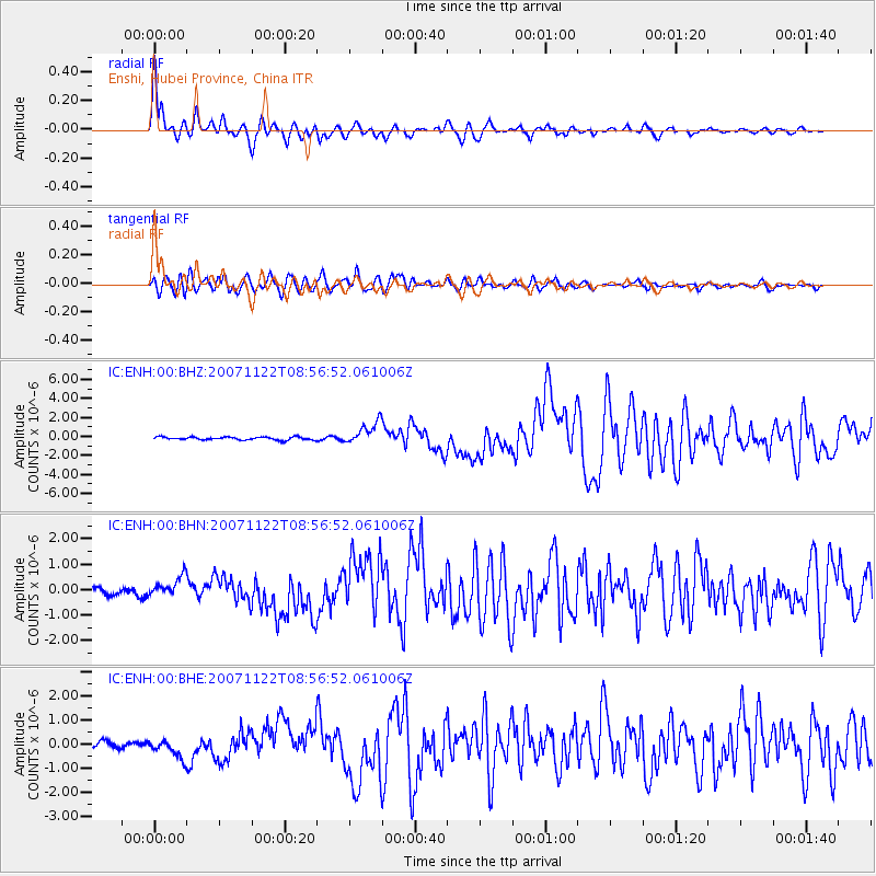
Signal To Noise
| Channel | StoN | STA | LTA |
| IC:ENH:00:BHN:20071122T08:56:52.061006Z | 2.035686 | 4.0976363E-7 | 2.0129018E-7 |
| IC:ENH:00:BHE:20071122T08:56:52.061006Z | 2.1917598 | 3.808437E-7 | 1.737616E-7 |
| IC:ENH:00:BHZ:20071122T08:56:52.061006Z | 7.43732 | 1.1578616E-6 | 1.5568263E-7 |
| Arrivals |
| Ps | 6.4 SECOND |
| PpPs | 16 SECOND |
| PsPs/PpSs | 23 SECOND |


