ENH Enshi, Hubei Province, China - Earthquake Result Viewer
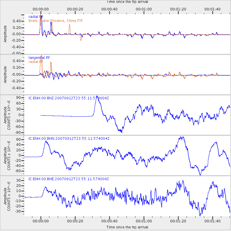
Earthquake location: Southern Sumatra, Indonesia
Earthquake latitude/longitude: -2.6/100.8
Earthquake time(UTC): 2007/09/12 (255) 23:49:03 GMT
Earthquake Depth: 35 km
Earthquake Magnitude: 6.6 MB, 8.1 MS, 7.9 MW, 7.6 ME
Earthquake Catalog/Contributor: WHDF/NEIC
Network: IC New China Digital Seismograph Network
Station: ENH Enshi, Hubei Province, China
Lat/Lon: 30.27 N/109.49 E
Elevation: 487 m
Distance: 33.7 deg
Az: 13.541 deg
Baz: 195.687 deg
Ray Param: 0.07801097
Estimated Moho Depth: 58.25 km
Estimated Crust Vp/Vs: 1.60
Assumed Crust Vp: 6.083 km/s
Estimated Crust Vs: 3.802 km/s
Estimated Crust Poisson's Ratio: 0.18
Radial Match: 94.40927 %
Radial Bump: 344
Transverse Match: 76.99313 %
Transverse Bump: 400
SOD ConfigId: 2564
Insert Time: 2010-03-04 21:55:03.392 +0000
GWidth: 2.5
Max Bumps: 400
Tol: 0.001

Signal To Noise

ChannelStoNSTALTA
IC:ENH:00:BHN:20070912T23:55:11.574004Z30.0495113.608096E-51.200717E-6
IC:ENH:00:BHE:20070912T23:55:11.574004Z29.1293241.1090336E-53.8072753E-7
IC:ENH:00:BHZ:20070912T23:55:11.574004Z32.471866.266022E-51.9296774E-6
Arrivals
Ps6.2 SECOND
PpPs23 SECOND
PsPs/PpSs29 SECOND