You are here: Home > Network List > TA - USArray Transportable Network (new EarthScope stations) Stations List
> Station O48A Farmland, IN, USA > Earthquake Result Viewer
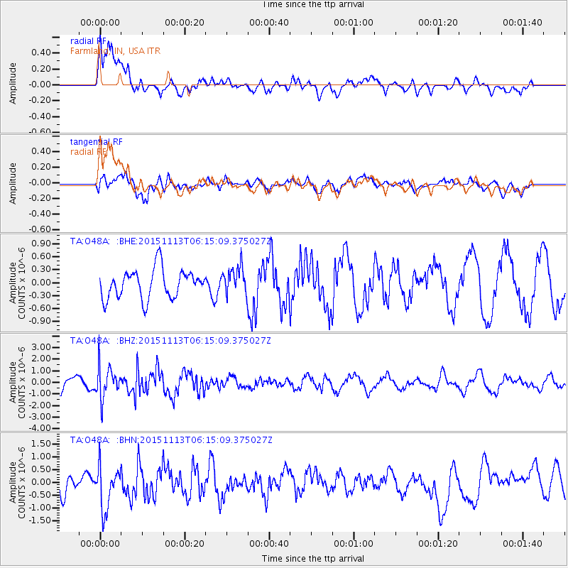
O48A Farmland, IN, USA - Earthquake Result Viewer
*The percent match for this event was below the threshold and hence no stack was calculated.
| Earthquake location: |
Santiago Del Estero Prov., Arg. |
| Earthquake latitude/longitude: |
-29.9/-64.5 |
| Earthquake time(UTC): |
2015/11/13 (317) 06:04:15 GMT |
| Earthquake Depth: |
11 km |
| Earthquake Magnitude: |
5.8 MWP |
| Earthquake Catalog/Contributor: |
NEIC PDE/NEIC COMCAT |
|
| Network: |
TA USArray Transportable Network (new EarthScope stations) |
| Station: |
O48A Farmland, IN, USA |
| Lat/Lon: |
40.26 N/85.16 W |
| Elevation: |
300 m |
|
| Distance: |
72.4 deg |
| Az: |
343.544 deg |
| Baz: |
161.244 deg |
| Ray Param: |
$rayparam |
*The percent match for this event was below the threshold and hence was not used in the summary stack. |
|
| Radial Match: |
58.14219 % |
| Radial Bump: |
400 |
| Transverse Match: |
65.76952 % |
| Transverse Bump: |
400 |
| SOD ConfigId: |
7422571 |
| Insert Time: |
2019-04-21 08:52:36.165 +0000 |
| GWidth: |
2.5 |
| Max Bumps: |
400 |
| Tol: |
0.001 |
|
Signal To Noise
| Channel | StoN | STA | LTA |
| TA:O48A: :BHZ:20151113T06:15:09.375027Z | 2.661376 | 1.3921218E-6 | 5.230835E-7 |
| TA:O48A: :BHN:20151113T06:15:09.375027Z | 1.3260095 | 8.463939E-7 | 6.383015E-7 |
| TA:O48A: :BHE:20151113T06:15:09.375027Z | 1.0349871 | 3.4798492E-7 | 3.3622152E-7 |
| Arrivals |
| Ps | |
| PpPs | |
| PsPs/PpSs | |


