ENH Enshi, Hubei Province, China - Earthquake Result Viewer
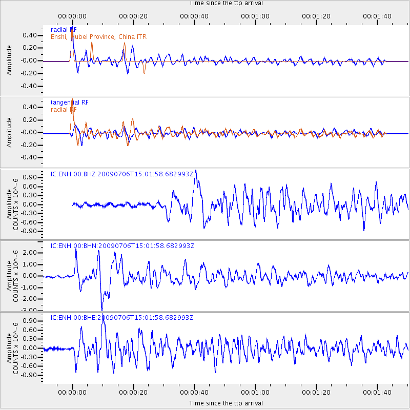
Earthquake location: Rat Islands, Aleutian Islands
Earthquake latitude/longitude: 50.4/177.0
Earthquake time(UTC): 2009/07/06 (187) 14:53:12 GMT
Earthquake Depth: 22 km
Earthquake Magnitude: 6.0 MB, 5.8 MS, 6.1 MW, 6.0 MW
Earthquake Catalog/Contributor: WHDF/NEIC
Network: IC New China Digital Seismograph Network
Station: ENH Enshi, Hubei Province, China
Lat/Lon: 30.27 N/109.49 E
Elevation: 487 m
Distance: 53.3 deg
Az: 274.741 deg
Baz: 47.449 deg
Ray Param: 0.066144995
Estimated Moho Depth: 40.75 km
Estimated Crust Vp/Vs: 1.65
Assumed Crust Vp: 6.083 km/s
Estimated Crust Vs: 3.681 km/s
Estimated Crust Poisson's Ratio: 0.21
Radial Match: 91.28847 %
Radial Bump: 400
Transverse Match: 85.102325 %
Transverse Bump: 400
SOD ConfigId: 2648
Insert Time: 2010-03-04 21:56:17.365 +0000
GWidth: 2.5
Max Bumps: 400
Tol: 0.001

Signal To Noise

ChannelStoNSTALTA
IC:ENH:00:BHN:20090706T15:01:58.682993Z15.99344358.0308035E-75.0213096E-8
IC:ENH:00:BHE:20090706T15:01:58.682993Z8.8550273.4768203E-73.9263803E-8
IC:ENH:00:BHZ:20090706T15:01:58.682993Z6.68526362.8873205E-74.318933E-8
Arrivals
Ps4.6 SECOND
PpPs17 SECOND
PsPs/PpSs21 SECOND