You are here: Home > Network List > TA - USArray Transportable Network (new EarthScope stations) Stations List
> Station M31M Drury Creek, Yukon, CA > Earthquake Result Viewer
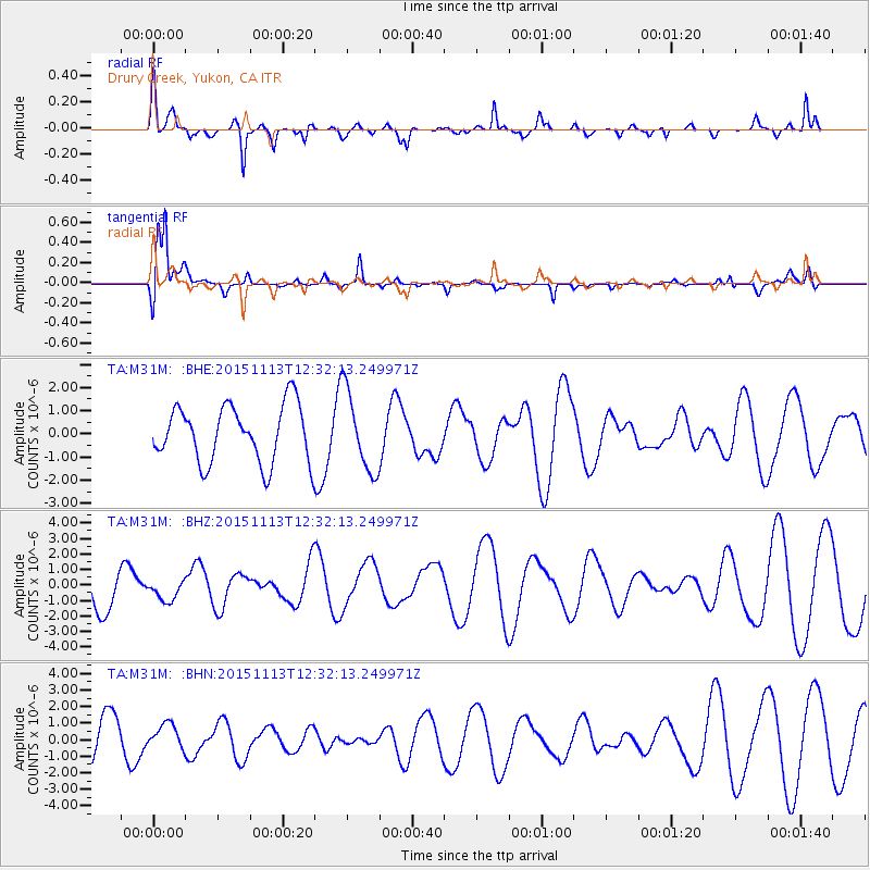
M31M Drury Creek, Yukon, CA - Earthquake Result Viewer
*The percent match for this event was below the threshold and hence no stack was calculated.
| Earthquake location: |
Mariana Islands Region |
| Earthquake latitude/longitude: |
17.3/147.2 |
| Earthquake time(UTC): |
2015/11/13 (317) 12:21:37 GMT |
| Earthquake Depth: |
16 km |
| Earthquake Magnitude: |
5.4 mwb |
| Earthquake Catalog/Contributor: |
NEIC PDE/us |
|
| Network: |
TA USArray Transportable Network (new EarthScope stations) |
| Station: |
M31M Drury Creek, Yukon, CA |
| Lat/Lon: |
62.20 N/134.39 W |
| Elevation: |
639 m |
|
| Distance: |
69.5 deg |
| Az: |
29.366 deg |
| Baz: |
268.085 deg |
| Ray Param: |
$rayparam |
*The percent match for this event was below the threshold and hence was not used in the summary stack. |
|
| Radial Match: |
68.90782 % |
| Radial Bump: |
400 |
| Transverse Match: |
82.76879 % |
| Transverse Bump: |
400 |
| SOD ConfigId: |
7422571 |
| Insert Time: |
2019-04-21 08:59:47.852 +0000 |
| GWidth: |
2.5 |
| Max Bumps: |
400 |
| Tol: |
0.001 |
|
Signal To Noise
| Channel | StoN | STA | LTA |
| TA:M31M: :BHZ:20151113T12:32:13.249971Z | 0.30203786 | 6.5650005E-7 | 2.1735686E-6 |
| TA:M31M: :BHN:20151113T12:32:13.249971Z | 0.42458767 | 7.0610173E-7 | 1.6630293E-6 |
| TA:M31M: :BHE:20151113T12:32:13.249971Z | 1.4147414 | 1.7379635E-6 | 1.2284673E-6 |
| Arrivals |
| Ps | |
| PpPs | |
| PsPs/PpSs | |


