You are here: Home > Network List > US - United States National Seismic Network Stations List
> Station AMTX Amarillo, Texas, USA > Earthquake Result Viewer
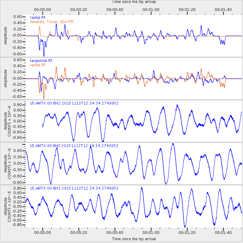
AMTX Amarillo, Texas, USA - Earthquake Result Viewer
*The percent match for this event was below the threshold and hence no stack was calculated.
| Earthquake location: |
Mariana Islands Region |
| Earthquake latitude/longitude: |
17.3/147.2 |
| Earthquake time(UTC): |
2015/11/13 (317) 12:21:37 GMT |
| Earthquake Depth: |
16 km |
| Earthquake Magnitude: |
5.4 mwb |
| Earthquake Catalog/Contributor: |
NEIC PDE/us |
|
| Network: |
US United States National Seismic Network |
| Station: |
AMTX Amarillo, Texas, USA |
| Lat/Lon: |
34.53 N/101.41 W |
| Elevation: |
1010 m |
|
| Distance: |
97.0 deg |
| Az: |
50.756 deg |
| Baz: |
296.328 deg |
| Ray Param: |
$rayparam |
*The percent match for this event was below the threshold and hence was not used in the summary stack. |
|
| Radial Match: |
69.58128 % |
| Radial Bump: |
400 |
| Transverse Match: |
52.185 % |
| Transverse Bump: |
400 |
| SOD ConfigId: |
7422571 |
| Insert Time: |
2019-04-21 09:00:19.834 +0000 |
| GWidth: |
2.5 |
| Max Bumps: |
400 |
| Tol: |
0.001 |
|
Signal To Noise
| Channel | StoN | STA | LTA |
| US:AMTX:00:BHZ:20151113T12:34:34.274995Z | 1.909468 | 5.2134504E-7 | 2.7303156E-7 |
| US:AMTX:00:BH1:20151113T12:34:34.274995Z | 1.0762926 | 3.07126E-7 | 2.8535547E-7 |
| US:AMTX:00:BH2:20151113T12:34:34.274995Z | 1.5448486 | 6.740264E-7 | 4.363058E-7 |
| Arrivals |
| Ps | |
| PpPs | |
| PsPs/PpSs | |


