You are here: Home > Network List > TA - USArray Transportable Network (new EarthScope stations) Stations List
> Station O03E Paynes Creek, CA, USA > Earthquake Result Viewer
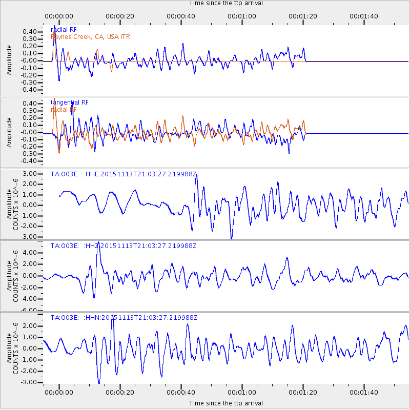
O03E Paynes Creek, CA, USA - Earthquake Result Viewer
*The percent match for this event was below the threshold and hence no stack was calculated.
| Earthquake location: |
Northwest Of Ryukyu Islands |
| Earthquake latitude/longitude: |
31.1/128.8 |
| Earthquake time(UTC): |
2015/11/13 (317) 20:51:32 GMT |
| Earthquake Depth: |
10 km |
| Earthquake Magnitude: |
6.5 MWB |
| Earthquake Catalog/Contributor: |
NEIC PDE/NEIC COMCAT |
|
| Network: |
TA USArray Transportable Network (new EarthScope stations) |
| Station: |
O03E Paynes Creek, CA, USA |
| Lat/Lon: |
40.29 N/121.80 W |
| Elevation: |
967 m |
|
| Distance: |
83.5 deg |
| Az: |
46.565 deg |
| Baz: |
305.438 deg |
| Ray Param: |
$rayparam |
*The percent match for this event was below the threshold and hence was not used in the summary stack. |
|
| Radial Match: |
59.425293 % |
| Radial Bump: |
400 |
| Transverse Match: |
54.25354 % |
| Transverse Bump: |
400 |
| SOD ConfigId: |
7422571 |
| Insert Time: |
2019-04-21 09:07:05.747 +0000 |
| GWidth: |
2.5 |
| Max Bumps: |
400 |
| Tol: |
0.001 |
|
Signal To Noise
| Channel | StoN | STA | LTA |
| TA:O03E: :HHZ:20151113T21:03:27.219988Z | 0.45186135 | 1.8227209E-7 | 4.0338054E-7 |
| TA:O03E: :HHN:20151113T21:03:27.219988Z | 1.1918435 | 4.6680188E-7 | 3.9166375E-7 |
| TA:O03E: :HHE:20151113T21:03:27.219988Z | 0.93062085 | 5.896287E-7 | 6.335864E-7 |
| Arrivals |
| Ps | |
| PpPs | |
| PsPs/PpSs | |


