You are here: Home > Network List > AV - Alaska Volcano Observatory Stations List
> Station AMKA Regional Station, Amchitka Island, Alaska > Earthquake Result Viewer
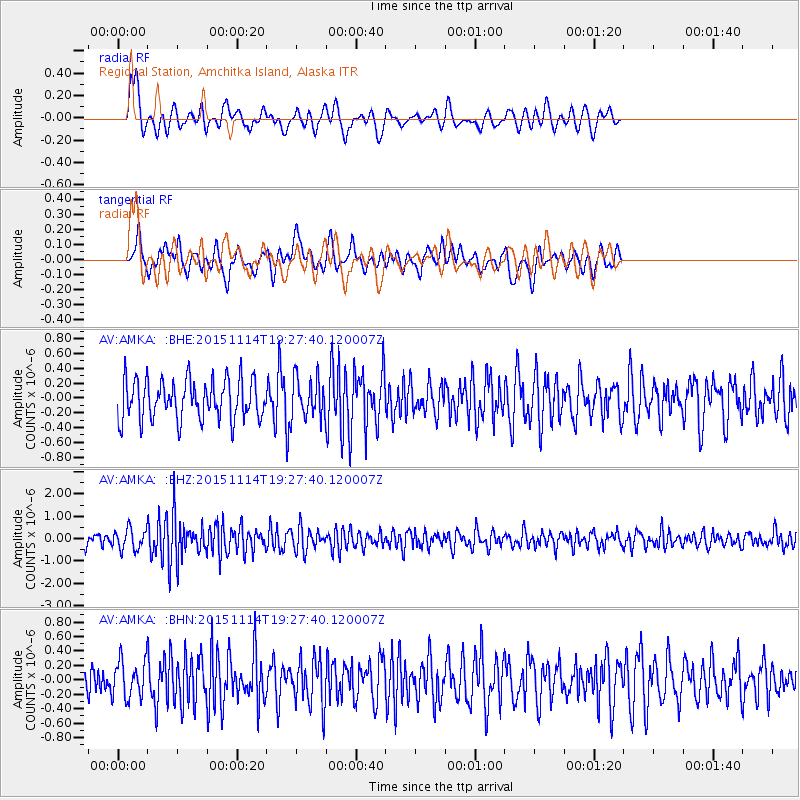
AMKA Regional Station, Amchitka Island, Alaska - Earthquake Result Viewer
*The percent match for this event was below the threshold and hence no stack was calculated.
| Earthquake location: |
Northwest Of Ryukyu Islands |
| Earthquake latitude/longitude: |
31.4/129.0 |
| Earthquake time(UTC): |
2015/11/14 (318) 19:20:21 GMT |
| Earthquake Depth: |
26 km |
| Earthquake Magnitude: |
5.7 MB |
| Earthquake Catalog/Contributor: |
NEIC PDE/NEIC ALERT |
|
| Network: |
AV Alaska Volcano Observatory |
| Station: |
AMKA Regional Station, Amchitka Island, Alaska |
| Lat/Lon: |
51.38 N/179.30 E |
| Elevation: |
116 m |
|
| Distance: |
41.7 deg |
| Az: |
46.457 deg |
| Baz: |
261.368 deg |
| Ray Param: |
$rayparam |
*The percent match for this event was below the threshold and hence was not used in the summary stack. |
|
| Radial Match: |
60.96261 % |
| Radial Bump: |
400 |
| Transverse Match: |
54.62404 % |
| Transverse Bump: |
364 |
| SOD ConfigId: |
7422571 |
| Insert Time: |
2019-04-21 09:10:21.597 +0000 |
| GWidth: |
2.5 |
| Max Bumps: |
400 |
| Tol: |
0.001 |
|
Signal To Noise
| Channel | StoN | STA | LTA |
| AV:AMKA: :BHZ:20151114T19:27:40.120007Z | 1.5509992 | 4.6855715E-7 | 3.0210018E-7 |
| AV:AMKA: :BHN:20151114T19:27:40.120007Z | 1.110314 | 2.5945522E-7 | 2.3367733E-7 |
| AV:AMKA: :BHE:20151114T19:27:40.120007Z | 1.3473405 | 3.6624476E-7 | 2.7182793E-7 |
| Arrivals |
| Ps | |
| PpPs | |
| PsPs/PpSs | |


