You are here: Home > Network List > TA - USArray Transportable Network (new EarthScope stations) Stations List
> Station O03E Paynes Creek, CA, USA > Earthquake Result Viewer
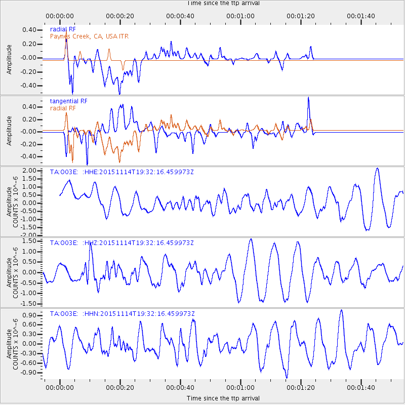
O03E Paynes Creek, CA, USA - Earthquake Result Viewer
*The percent match for this event was below the threshold and hence no stack was calculated.
| Earthquake location: |
Northwest Of Ryukyu Islands |
| Earthquake latitude/longitude: |
31.4/129.0 |
| Earthquake time(UTC): |
2015/11/14 (318) 19:20:21 GMT |
| Earthquake Depth: |
26 km |
| Earthquake Magnitude: |
5.7 MB |
| Earthquake Catalog/Contributor: |
NEIC PDE/NEIC ALERT |
|
| Network: |
TA USArray Transportable Network (new EarthScope stations) |
| Station: |
O03E Paynes Creek, CA, USA |
| Lat/Lon: |
40.29 N/121.80 W |
| Elevation: |
967 m |
|
| Distance: |
83.2 deg |
| Az: |
46.661 deg |
| Baz: |
305.624 deg |
| Ray Param: |
$rayparam |
*The percent match for this event was below the threshold and hence was not used in the summary stack. |
|
| Radial Match: |
65.7306 % |
| Radial Bump: |
400 |
| Transverse Match: |
69.2543 % |
| Transverse Bump: |
400 |
| SOD ConfigId: |
7422571 |
| Insert Time: |
2019-04-21 09:14:45.139 +0000 |
| GWidth: |
2.5 |
| Max Bumps: |
400 |
| Tol: |
0.001 |
|
Signal To Noise
| Channel | StoN | STA | LTA |
| TA:O03E: :HHZ:20151114T19:32:16.459973Z | 1.0899086 | 3.2196127E-7 | 2.954021E-7 |
| TA:O03E: :HHN:20151114T19:32:16.459973Z | 0.7616224 | 4.7306378E-7 | 6.211264E-7 |
| TA:O03E: :HHE:20151114T19:32:16.459973Z | 1.1466453 | 7.2606537E-7 | 6.3320834E-7 |
| Arrivals |
| Ps | |
| PpPs | |
| PsPs/PpSs | |


