You are here: Home > Network List > TJ - Tajikistan National Seismic Network Stations List
> Station GARM Garm, Tajikistan > Earthquake Result Viewer
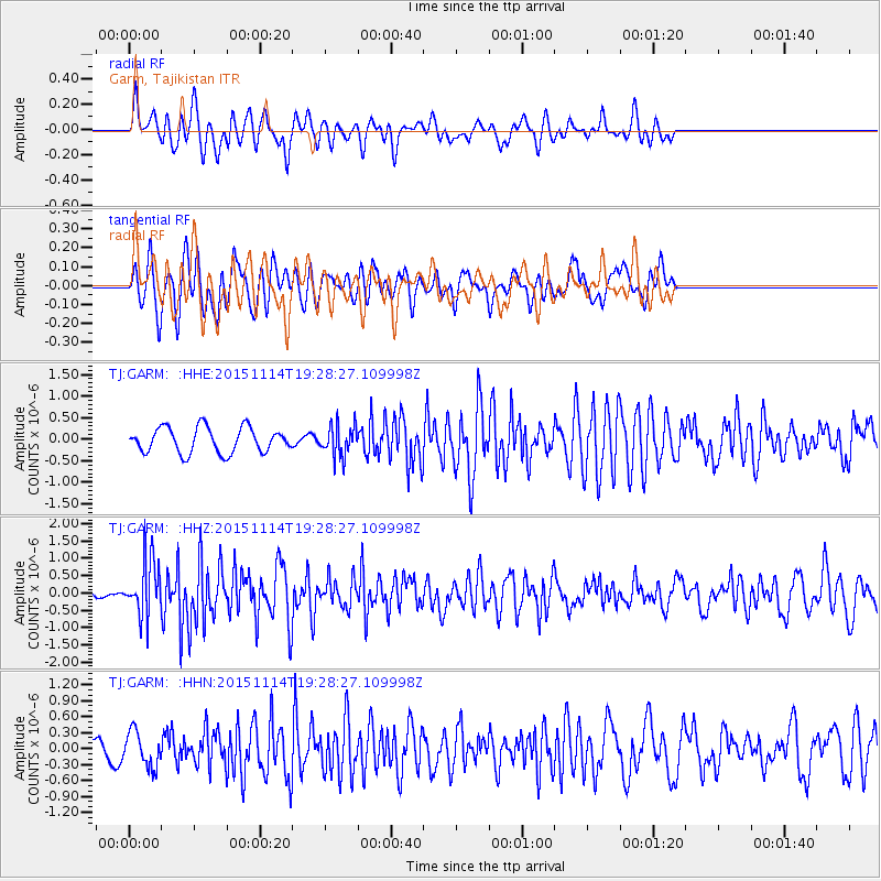
GARM Garm, Tajikistan - Earthquake Result Viewer
*The percent match for this event was below the threshold and hence no stack was calculated.
| Earthquake location: |
Northwest Of Ryukyu Islands |
| Earthquake latitude/longitude: |
31.4/129.0 |
| Earthquake time(UTC): |
2015/11/14 (318) 19:20:21 GMT |
| Earthquake Depth: |
26 km |
| Earthquake Magnitude: |
5.7 MB |
| Earthquake Catalog/Contributor: |
NEIC PDE/NEIC ALERT |
|
| Network: |
TJ Tajikistan National Seismic Network |
| Station: |
GARM Garm, Tajikistan |
| Lat/Lon: |
39.00 N/70.32 E |
| Elevation: |
1305 m |
|
| Distance: |
47.8 deg |
| Az: |
296.059 deg |
| Baz: |
80.244 deg |
| Ray Param: |
$rayparam |
*The percent match for this event was below the threshold and hence was not used in the summary stack. |
|
| Radial Match: |
62.473293 % |
| Radial Bump: |
346 |
| Transverse Match: |
62.43984 % |
| Transverse Bump: |
400 |
| SOD ConfigId: |
7422571 |
| Insert Time: |
2019-04-21 09:14:54.478 +0000 |
| GWidth: |
2.5 |
| Max Bumps: |
400 |
| Tol: |
0.001 |
|
Signal To Noise
| Channel | StoN | STA | LTA |
| TJ:GARM: :HHZ:20151114T19:28:27.109998Z | 5.9739847 | 8.1461354E-7 | 1.3636017E-7 |
| TJ:GARM: :HHN:20151114T19:28:27.109998Z | 2.182833 | 3.2722747E-7 | 1.4990954E-7 |
| TJ:GARM: :HHE:20151114T19:28:27.109998Z | 1.1056794 | 3.2773255E-7 | 2.964083E-7 |
| Arrivals |
| Ps | |
| PpPs | |
| PsPs/PpSs | |


