You are here: Home > Network List > AK - Alaska Regional Network Stations List
> Station CUT Chulitna, AK, USA > Earthquake Result Viewer
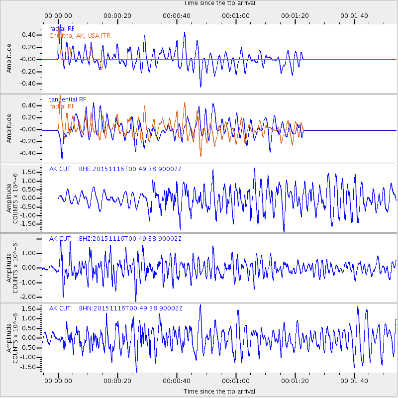
CUT Chulitna, AK, USA - Earthquake Result Viewer
*The percent match for this event was below the threshold and hence no stack was calculated.
| Earthquake location: |
North Of Honduras |
| Earthquake latitude/longitude: |
17.8/-81.8 |
| Earthquake time(UTC): |
2015/11/16 (320) 00:39:33 GMT |
| Earthquake Depth: |
9.1 km |
| Earthquake Magnitude: |
5.8 MWP |
| Earthquake Catalog/Contributor: |
NEIC PDE/NEIC COMCAT |
|
| Network: |
AK Alaska Regional Network |
| Station: |
CUT Chulitna, AK, USA |
| Lat/Lon: |
62.41 N/150.26 W |
| Elevation: |
574 m |
|
| Distance: |
64.4 deg |
| Az: |
331.295 deg |
| Baz: |
100.749 deg |
| Ray Param: |
$rayparam |
*The percent match for this event was below the threshold and hence was not used in the summary stack. |
|
| Radial Match: |
65.29448 % |
| Radial Bump: |
342 |
| Transverse Match: |
62.79448 % |
| Transverse Bump: |
400 |
| SOD ConfigId: |
7422571 |
| Insert Time: |
2019-04-21 09:17:49.126 +0000 |
| GWidth: |
2.5 |
| Max Bumps: |
400 |
| Tol: |
0.001 |
|
Signal To Noise
| Channel | StoN | STA | LTA |
| AK:CUT: :BHZ:20151116T00:49:38.90002Z | 5.136404 | 8.375632E-7 | 1.6306412E-7 |
| AK:CUT: :BHN:20151116T00:49:38.90002Z | 0.5506304 | 2.689765E-7 | 4.8848824E-7 |
| AK:CUT: :BHE:20151116T00:49:38.90002Z | 1.8230637 | 5.485581E-7 | 3.0089902E-7 |
| Arrivals |
| Ps | |
| PpPs | |
| PsPs/PpSs | |


