You are here: Home > Network List > AK - Alaska Regional Network Stations List
> Station MDM Murphy Dome > Earthquake Result Viewer
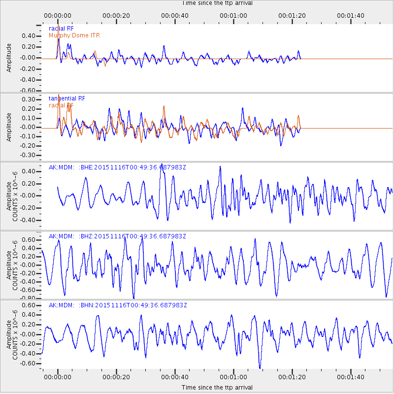
MDM Murphy Dome - Earthquake Result Viewer
*The percent match for this event was below the threshold and hence no stack was calculated.
| Earthquake location: |
North Of Honduras |
| Earthquake latitude/longitude: |
17.8/-81.8 |
| Earthquake time(UTC): |
2015/11/16 (320) 00:39:33 GMT |
| Earthquake Depth: |
9.1 km |
| Earthquake Magnitude: |
5.8 MWP |
| Earthquake Catalog/Contributor: |
NEIC PDE/NEIC COMCAT |
|
| Network: |
AK Alaska Regional Network |
| Station: |
MDM Murphy Dome |
| Lat/Lon: |
64.96 N/148.23 W |
| Elevation: |
634 m |
|
| Distance: |
64.0 deg |
| Az: |
334.291 deg |
| Baz: |
103.874 deg |
| Ray Param: |
$rayparam |
*The percent match for this event was below the threshold and hence was not used in the summary stack. |
|
| Radial Match: |
50.604076 % |
| Radial Bump: |
400 |
| Transverse Match: |
60.010838 % |
| Transverse Bump: |
400 |
| SOD ConfigId: |
7422571 |
| Insert Time: |
2019-04-21 09:18:03.848 +0000 |
| GWidth: |
2.5 |
| Max Bumps: |
400 |
| Tol: |
0.001 |
|
Signal To Noise
| Channel | StoN | STA | LTA |
| AK:MDM: :BHZ:20151116T00:49:36.687983Z | 2.32778 | 4.318079E-7 | 1.8550202E-7 |
| AK:MDM: :BHN:20151116T00:49:36.687983Z | 0.7452135 | 1.2755349E-7 | 1.7116369E-7 |
| AK:MDM: :BHE:20151116T00:49:36.687983Z | 1.6225024 | 1.9296749E-7 | 1.18932014E-7 |
| Arrivals |
| Ps | |
| PpPs | |
| PsPs/PpSs | |


