ENH Enshi, Hubei Province, China - Earthquake Result Viewer
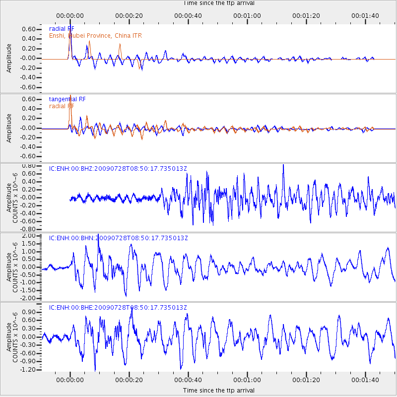
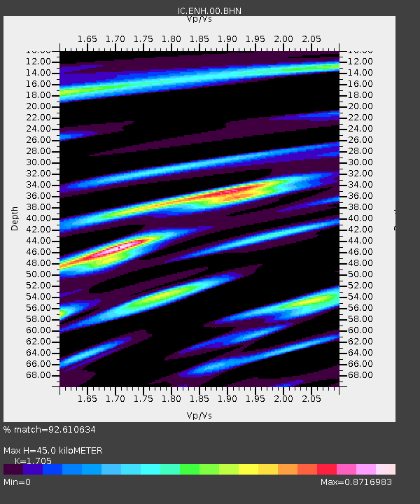
Earthquake location: Southwest Of Sumatra, Indonesia
Earthquake latitude/longitude: -5.5/101.7
Earthquake time(UTC): 2009/07/28 (209) 08:43:44 GMT
Earthquake Depth: 10 km
Earthquake Magnitude: 5.6 MB, 5.5 MS, 5.6 MW, 5.6 MW
Earthquake Catalog/Contributor: WHDF/NEIC
Network: IC New China Digital Seismograph Network
Station: ENH Enshi, Hubei Province, China
Lat/Lon: 30.27 N/109.49 E
Elevation: 487 m
Distance: 36.3 deg
Az: 11.412 deg
Baz: 193.161 deg
Ray Param: 0.07673046
Estimated Moho Depth: 45.0 km
Estimated Crust Vp/Vs: 1.71
Assumed Crust Vp: 6.083 km/s
Estimated Crust Vs: 3.568 km/s
Estimated Crust Poisson's Ratio: 0.24
Radial Match: 92.610634 %
Radial Bump: 400
Transverse Match: 80.6256 %
Transverse Bump: 400
SOD ConfigId: 2648
Insert Time: 2010-03-04 21:58:43.014 +0000
GWidth: 2.5
Max Bumps: 400
Tol: 0.001

Signal To Noise

ChannelStoNSTALTA
IC:ENH:00:BHN:20090728T08:50:17.735013Z7.79407266.7844525E-78.704631E-8
IC:ENH:00:BHE:20090728T08:50:17.735013Z5.35553933.6990306E-76.9069245E-8
IC:ENH:00:BHZ:20090728T08:50:17.735013Z2.83284971.5583015E-75.5008265E-8
Arrivals
Ps5.6 SECOND
PpPs19 SECOND
PsPs/PpSs24 SECOND