You are here: Home > Network List > CI - Caltech Regional Seismic Network Stations List
> Station TIN Tinemaha, Big Pine, CA, USA > Earthquake Result Viewer
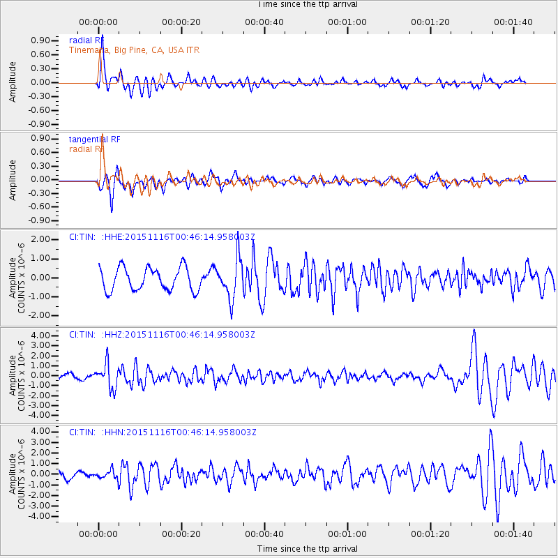
TIN Tinemaha, Big Pine, CA, USA - Earthquake Result Viewer
*The percent match for this event was below the threshold and hence no stack was calculated.
| Earthquake location: |
North Of Honduras |
| Earthquake latitude/longitude: |
17.8/-81.8 |
| Earthquake time(UTC): |
2015/11/16 (320) 00:39:33 GMT |
| Earthquake Depth: |
9.1 km |
| Earthquake Magnitude: |
5.8 MWP |
| Earthquake Catalog/Contributor: |
NEIC PDE/NEIC COMCAT |
|
| Network: |
CI Caltech Regional Seismic Network |
| Station: |
TIN Tinemaha, Big Pine, CA, USA |
| Lat/Lon: |
37.05 N/118.23 W |
| Elevation: |
1197 m |
|
| Distance: |
37.2 deg |
| Az: |
308.337 deg |
| Baz: |
110.951 deg |
| Ray Param: |
$rayparam |
*The percent match for this event was below the threshold and hence was not used in the summary stack. |
|
| Radial Match: |
72.245926 % |
| Radial Bump: |
400 |
| Transverse Match: |
59.501244 % |
| Transverse Bump: |
400 |
| SOD ConfigId: |
7422571 |
| Insert Time: |
2019-04-21 09:19:50.387 +0000 |
| GWidth: |
2.5 |
| Max Bumps: |
400 |
| Tol: |
0.001 |
|
Signal To Noise
| Channel | StoN | STA | LTA |
| CI:TIN: :HHZ:20151116T00:46:14.958003Z | 4.594992 | 1.2654643E-6 | 2.7540077E-7 |
| CI:TIN: :HHN:20151116T00:46:14.958003Z | 0.7277036 | 4.3142796E-7 | 5.928622E-7 |
| CI:TIN: :HHE:20151116T00:46:14.958003Z | 1.8134385 | 1.0843119E-6 | 5.9793143E-7 |
| Arrivals |
| Ps | |
| PpPs | |
| PsPs/PpSs | |


