You are here: Home > Network List > CN - Canadian National Seismograph Network Stations List
> Station INK INUVIK, NT > Earthquake Result Viewer
INK INUVIK, NT - Earthquake Result Viewer
*The percent match for this event was below the threshold and hence no stack was calculated.
| Earthquake location: |
North Of Honduras |
| Earthquake latitude/longitude: |
17.8/-81.8 |
| Earthquake time(UTC): |
2015/11/16 (320) 00:39:33 GMT |
| Earthquake Depth: |
9.1 km |
| Earthquake Magnitude: |
5.8 MWP |
| Earthquake Catalog/Contributor: |
NEIC PDE/NEIC COMCAT |
|
| Network: |
CN Canadian National Seismograph Network |
| Station: |
INK INUVIK, NT |
| Lat/Lon: |
68.31 N/133.53 W |
| Elevation: |
44 m |
|
| Distance: |
59.8 deg |
| Az: |
340.284 deg |
| Baz: |
120.198 deg |
| Ray Param: |
$rayparam |
*The percent match for this event was below the threshold and hence was not used in the summary stack. |
|
| Radial Match: |
59.00208 % |
| Radial Bump: |
400 |
| Transverse Match: |
37.601055 % |
| Transverse Bump: |
400 |
| SOD ConfigId: |
7422571 |
| Insert Time: |
2019-04-21 09:20:02.789 +0000 |
| GWidth: |
2.5 |
| Max Bumps: |
400 |
| Tol: |
0.001 |
|
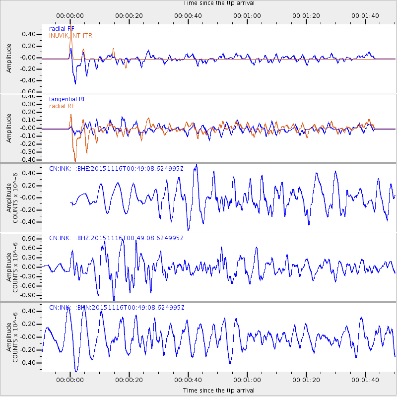
Signal To Noise
| Channel | StoN | STA | LTA |
| CN:INK: :BHZ:20151116T00:49:08.624995Z | 1.7426895 | 2.3525453E-7 | 1.3499509E-7 |
| CN:INK: :BHN:20151116T00:49:08.624995Z | 3.2239316 | 3.7488738E-7 | 1.1628267E-7 |
| CN:INK: :BHE:20151116T00:49:08.624995Z | 1.4860163 | 2.0013917E-7 | 1.3468168E-7 |
| Arrivals |
| Ps | |
| PpPs | |
| PsPs/PpSs | |


