You are here: Home > Network List > TA - USArray Transportable Network (new EarthScope stations) Stations List
> Station A21K Barrow, AK, USA > Earthquake Result Viewer
A21K Barrow, AK, USA - Earthquake Result Viewer
*The percent match for this event was below the threshold and hence no stack was calculated.
| Earthquake location: |
North Of Honduras |
| Earthquake latitude/longitude: |
17.8/-81.8 |
| Earthquake time(UTC): |
2015/11/16 (320) 00:39:33 GMT |
| Earthquake Depth: |
9.1 km |
| Earthquake Magnitude: |
5.8 MWP |
| Earthquake Catalog/Contributor: |
NEIC PDE/NEIC COMCAT |
|
| Network: |
TA USArray Transportable Network (new EarthScope stations) |
| Station: |
A21K Barrow, AK, USA |
| Lat/Lon: |
71.32 N/156.62 W |
| Elevation: |
577 m |
|
| Distance: |
68.4 deg |
| Az: |
340.46 deg |
| Baz: |
98.576 deg |
| Ray Param: |
$rayparam |
*The percent match for this event was below the threshold and hence was not used in the summary stack. |
|
| Radial Match: |
47.6883 % |
| Radial Bump: |
359 |
| Transverse Match: |
59.31875 % |
| Transverse Bump: |
400 |
| SOD ConfigId: |
7422571 |
| Insert Time: |
2019-04-21 09:22:12.660 +0000 |
| GWidth: |
2.5 |
| Max Bumps: |
400 |
| Tol: |
0.001 |
|
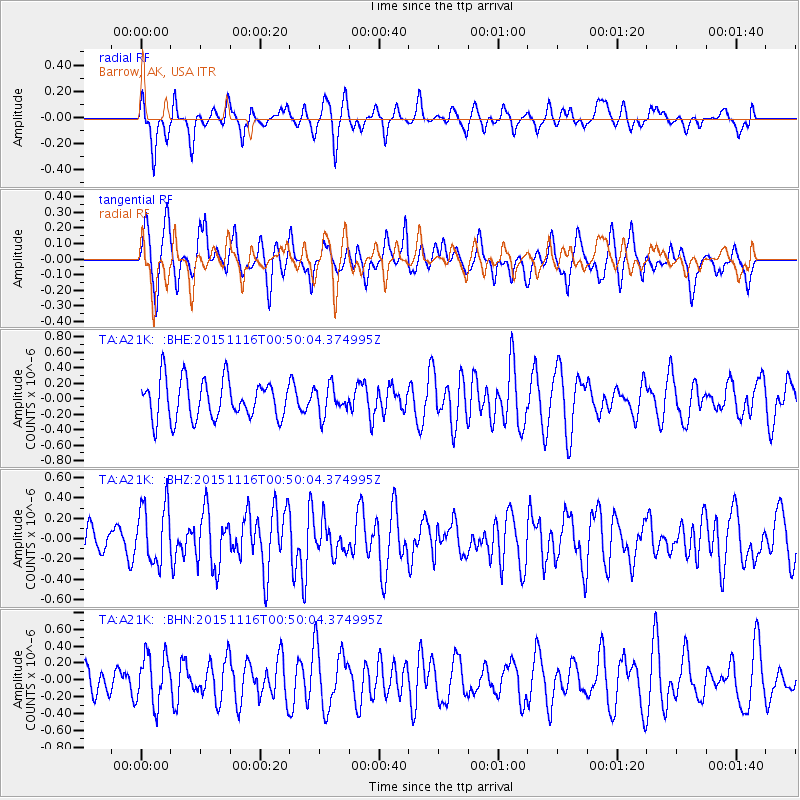
Signal To Noise
| Channel | StoN | STA | LTA |
| TA:A21K: :BHZ:20151116T00:50:04.374995Z | 2.5946846 | 2.9112772E-7 | 1.12201576E-7 |
| TA:A21K: :BHN:20151116T00:50:04.374995Z | 1.2699113 | 2.9296402E-7 | 2.3069644E-7 |
| TA:A21K: :BHE:20151116T00:50:04.374995Z | 0.72047865 | 1.825179E-7 | 2.5332866E-7 |
| Arrivals |
| Ps | |
| PpPs | |
| PsPs/PpSs | |


