You are here: Home > Network List > TA - USArray Transportable Network (new EarthScope stations) Stations List
> Station C06D Leavenworth, WQ, USA > Earthquake Result Viewer
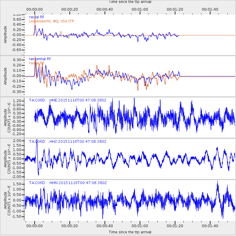
C06D Leavenworth, WQ, USA - Earthquake Result Viewer
*The percent match for this event was below the threshold and hence no stack was calculated.
| Earthquake location: |
North Of Honduras |
| Earthquake latitude/longitude: |
17.8/-81.8 |
| Earthquake time(UTC): |
2015/11/16 (320) 00:39:33 GMT |
| Earthquake Depth: |
9.1 km |
| Earthquake Magnitude: |
5.8 MWP |
| Earthquake Catalog/Contributor: |
NEIC PDE/NEIC COMCAT |
|
| Network: |
TA USArray Transportable Network (new EarthScope stations) |
| Station: |
C06D Leavenworth, WQ, USA |
| Lat/Lon: |
47.92 N/120.89 W |
| Elevation: |
544 m |
|
| Distance: |
43.7 deg |
| Az: |
322.17 deg |
| Baz: |
119.712 deg |
| Ray Param: |
$rayparam |
*The percent match for this event was below the threshold and hence was not used in the summary stack. |
|
| Radial Match: |
56.720974 % |
| Radial Bump: |
394 |
| Transverse Match: |
57.47593 % |
| Transverse Bump: |
400 |
| SOD ConfigId: |
7422571 |
| Insert Time: |
2019-04-21 09:22:15.386 +0000 |
| GWidth: |
2.5 |
| Max Bumps: |
400 |
| Tol: |
0.001 |
|
Signal To Noise
| Channel | StoN | STA | LTA |
| TA:C06D: :HHZ:20151116T00:47:08.380Z | 4.44226 | 8.743044E-7 | 1.9681524E-7 |
| TA:C06D: :HHN:20151116T00:47:08.380Z | 1.2668355 | 4.920883E-7 | 3.8843902E-7 |
| TA:C06D: :HHE:20151116T00:47:08.380Z | 1.3336618 | 4.621828E-7 | 3.4655173E-7 |
| Arrivals |
| Ps | |
| PpPs | |
| PsPs/PpSs | |


