You are here: Home > Network List > UW - Pacific Northwest Regional Seismic Network Stations List
> Station PASS Maple Falls, WA, USA > Earthquake Result Viewer
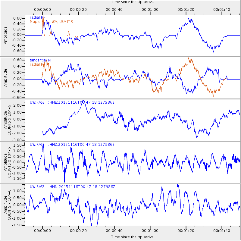
PASS Maple Falls, WA, USA - Earthquake Result Viewer
*The percent match for this event was below the threshold and hence no stack was calculated.
| Earthquake location: |
North Of Honduras |
| Earthquake latitude/longitude: |
17.8/-81.8 |
| Earthquake time(UTC): |
2015/11/16 (320) 00:39:33 GMT |
| Earthquake Depth: |
9.1 km |
| Earthquake Magnitude: |
5.8 MWP |
| Earthquake Catalog/Contributor: |
NEIC PDE/NEIC COMCAT |
|
| Network: |
UW Pacific Northwest Regional Seismic Network |
| Station: |
PASS Maple Falls, WA, USA |
| Lat/Lon: |
49.00 N/122.09 W |
| Elevation: |
174 m |
|
| Distance: |
44.9 deg |
| Az: |
322.951 deg |
| Baz: |
119.381 deg |
| Ray Param: |
$rayparam |
*The percent match for this event was below the threshold and hence was not used in the summary stack. |
|
| Radial Match: |
22.638725 % |
| Radial Bump: |
400 |
| Transverse Match: |
37.379738 % |
| Transverse Bump: |
400 |
| SOD ConfigId: |
7422571 |
| Insert Time: |
2019-04-21 09:23:04.728 +0000 |
| GWidth: |
2.5 |
| Max Bumps: |
400 |
| Tol: |
0.001 |
|
Signal To Noise
| Channel | StoN | STA | LTA |
| UW:PASS: :HHZ:20151116T00:47:18.127986Z | 2.0264144 | 7.986223E-7 | 3.9410614E-7 |
| UW:PASS: :HHN:20151116T00:47:18.127986Z | 0.55253744 | 4.1775948E-7 | 7.5607454E-7 |
| UW:PASS: :HHE:20151116T00:47:18.127986Z | 0.6911404 | 1.0299918E-6 | 1.4902787E-6 |
| Arrivals |
| Ps | |
| PpPs | |
| PsPs/PpSs | |


