You are here: Home > Network List > IC - New China Digital Seismograph Network Stations List
> Station ENH Enshi, Hubei Province, China > Earthquake Result Viewer
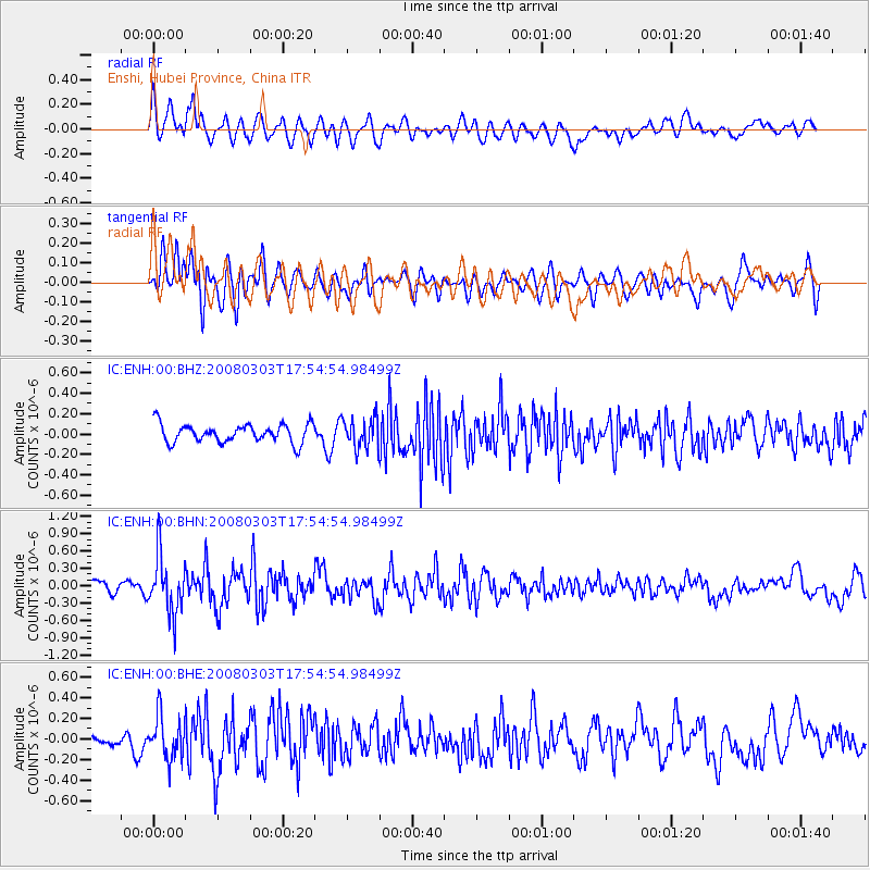
ENH Enshi, Hubei Province, China - Earthquake Result Viewer
*The percent match for this event was below the threshold and hence no stack was calculated.
| Earthquake location: |
Southern Sumatra, Indonesia |
| Earthquake latitude/longitude: |
-4.5/101.5 |
| Earthquake time(UTC): |
2008/03/03 (063) 17:48:32 GMT |
| Earthquake Depth: |
28 km |
| Earthquake Magnitude: |
5.6 MB, 5.0 MS |
| Earthquake Catalog/Contributor: |
WHDF/NEIC |
|
| Network: |
IC New China Digital Seismograph Network |
| Station: |
ENH Enshi, Hubei Province, China |
| Lat/Lon: |
30.27 N/109.49 E |
| Elevation: |
487 m |
|
| Distance: |
35.4 deg |
| Az: |
12.052 deg |
| Baz: |
193.924 deg |
| Ray Param: |
$rayparam |
*The percent match for this event was below the threshold and hence was not used in the summary stack. |
|
| Radial Match: |
55.708153 % |
| Radial Bump: |
400 |
| Transverse Match: |
59.95303 % |
| Transverse Bump: |
400 |
| SOD ConfigId: |
2504 |
| Insert Time: |
2010-03-04 21:59:17.149 +0000 |
| GWidth: |
2.5 |
| Max Bumps: |
400 |
| Tol: |
0.001 |
|
Signal To Noise
| Channel | StoN | STA | LTA |
| IC:ENH:00:BHN:20080303T17:54:54.98499Z | 4.6913323 | 4.961159E-7 | 1.0575159E-7 |
| IC:ENH:00:BHE:20080303T17:54:54.98499Z | 1.7292833 | 2.1007197E-7 | 1.2147922E-7 |
| IC:ENH:00:BHZ:20080303T17:54:54.98499Z | 1.6308784 | 1.4729565E-7 | 9.031675E-8 |
| Arrivals |
| Ps | |
| PpPs | |
| PsPs/PpSs | |


