You are here: Home > Network List > IC - New China Digital Seismograph Network Stations List
> Station ENH Enshi, Hubei Province, China > Earthquake Result Viewer
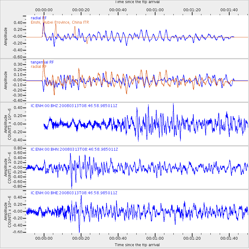
ENH Enshi, Hubei Province, China - Earthquake Result Viewer
*The percent match for this event was below the threshold and hence no stack was calculated.
| Earthquake location: |
Kuril Islands |
| Earthquake latitude/longitude: |
43.1/146.5 |
| Earthquake time(UTC): |
2008/03/13 (073) 08:41:07 GMT |
| Earthquake Depth: |
53 km |
| Earthquake Magnitude: |
5.6 MB, 5.4 MW, 5.3 MW |
| Earthquake Catalog/Contributor: |
WHDF/NEIC |
|
| Network: |
IC New China Digital Seismograph Network |
| Station: |
ENH Enshi, Hubei Province, China |
| Lat/Lon: |
30.27 N/109.49 E |
| Elevation: |
487 m |
|
| Distance: |
32.1 deg |
| Az: |
258.899 deg |
| Baz: |
56.229 deg |
| Ray Param: |
$rayparam |
*The percent match for this event was below the threshold and hence was not used in the summary stack. |
|
| Radial Match: |
69.68849 % |
| Radial Bump: |
400 |
| Transverse Match: |
62.17556 % |
| Transverse Bump: |
400 |
| SOD ConfigId: |
2504 |
| Insert Time: |
2010-03-04 21:59:17.609 +0000 |
| GWidth: |
2.5 |
| Max Bumps: |
400 |
| Tol: |
0.001 |
|
Signal To Noise
| Channel | StoN | STA | LTA |
| IC:ENH:00:BHN:20080313T08:46:58.985011Z | 2.327731 | 1.3998925E-7 | 6.013979E-8 |
| IC:ENH:00:BHE:20080313T08:46:58.985011Z | 1.001886 | 6.717183E-8 | 6.7045384E-8 |
| IC:ENH:00:BHZ:20080313T08:46:58.985011Z | 0.9586591 | 6.1294195E-8 | 6.393742E-8 |
| Arrivals |
| Ps | |
| PpPs | |
| PsPs/PpSs | |


