You are here: Home > Network List > IC - New China Digital Seismograph Network Stations List
> Station ENH Enshi, Hubei Province, China > Earthquake Result Viewer
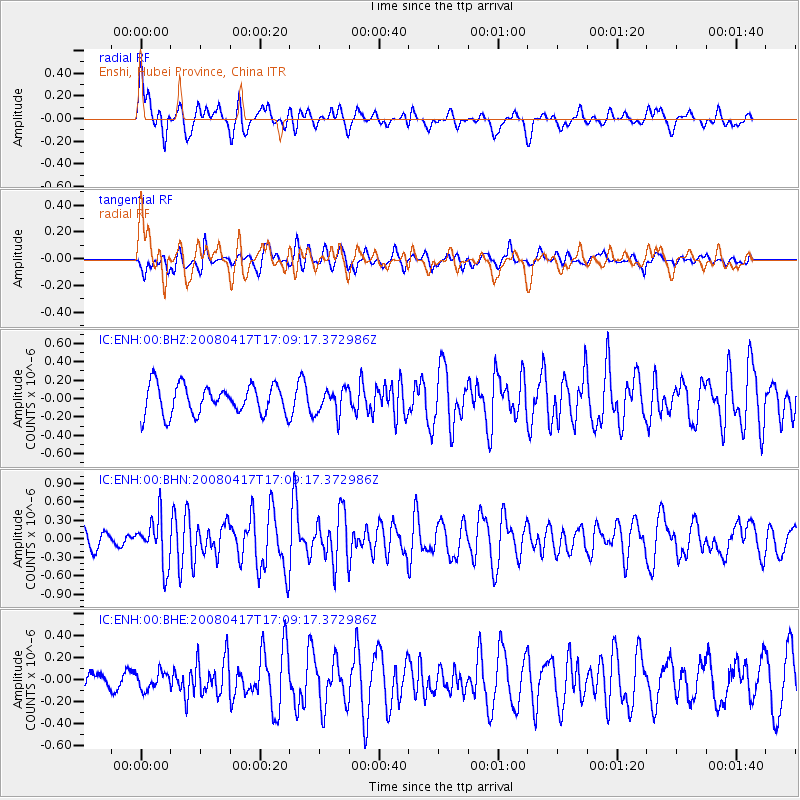
ENH Enshi, Hubei Province, China - Earthquake Result Viewer
*The percent match for this event was below the threshold and hence no stack was calculated.
| Earthquake location: |
Mariana Islands Region |
| Earthquake latitude/longitude: |
15.9/144.9 |
| Earthquake time(UTC): |
2008/04/17 (108) 17:02:52 GMT |
| Earthquake Depth: |
10 km |
| Earthquake Magnitude: |
5.5 MB, 5.2 MS, 5.5 MW, 5.5 MW |
| Earthquake Catalog/Contributor: |
WHDF/NEIC |
|
| Network: |
IC New China Digital Seismograph Network |
| Station: |
ENH Enshi, Hubei Province, China |
| Lat/Lon: |
30.27 N/109.49 E |
| Elevation: |
487 m |
|
| Distance: |
35.4 deg |
| Az: |
300.133 deg |
| Baz: |
105.843 deg |
| Ray Param: |
$rayparam |
*The percent match for this event was below the threshold and hence was not used in the summary stack. |
|
| Radial Match: |
72.424484 % |
| Radial Bump: |
400 |
| Transverse Match: |
69.53176 % |
| Transverse Bump: |
400 |
| SOD ConfigId: |
2504 |
| Insert Time: |
2010-03-04 21:59:23.813 +0000 |
| GWidth: |
2.5 |
| Max Bumps: |
400 |
| Tol: |
0.001 |
|
Signal To Noise
| Channel | StoN | STA | LTA |
| IC:ENH:00:BHN:20080417T17:09:17.372986Z | 2.7143981 | 3.8386162E-7 | 1.4141685E-7 |
| IC:ENH:00:BHE:20080417T17:09:17.372986Z | 0.89388347 | 7.7562746E-8 | 8.6770534E-8 |
| IC:ENH:00:BHZ:20080417T17:09:17.372986Z | 0.8738868 | 1.3896818E-7 | 1.5902309E-7 |
| Arrivals |
| Ps | |
| PpPs | |
| PsPs/PpSs | |


